May 12, 2020, by lzzeb
Workplace Views
A blog by David Matless
May 2020. The School of Geography, and its map collection, are locked down. The ‘Map of the Month’ blog is out to grass for now, but another element of the School collections has recently been restored to view, and provides the occasion for this piece. Within the School’s archive room is an extensive collection of glass slides, assembled decades ago for teaching, and including images of diagrams, maps and photographs. The equipment to view such slides is long gone, but the Department of Manuscripts and Special Collections at the King’s Meadow campus has collaborated with the School in digitising hundreds of slides relating to the East Midlands. The project has been organised and overseen by Mark Bentley at MSC, with the scanning undertaken by Nottingham Advantage Award placement students Annabel Stubbs and Rita Figueiredo, the latter a current second year geographer. We thank all those involved for opening up an aspect of the School’s history for view. For more on MSC see https://www.nottingham.ac.uk/manuscriptsandspecialcollections/index.aspx.
The photographic slides are labelled with brief details of subject and date. The photographers are not given, though were most likely members of the Department of Geography. The digitised images are clear, and zooming in reveals vivid detail. Here, in lockdown, we can ‘zoom’ to meet the past, and some of the slides show our own building, or views from close by. Neither members of the School nor other visitors can enter the building at present, but virtual history allows some reconnection to the workplace. Three images are examined, one a view from nearby Keighton Hill in 1960, several years before the building was constructed, the second a 1968 view from the roof of the new building, the third a 1967 Christmas view, shown at the head of this blog and discussed at its conclusion.
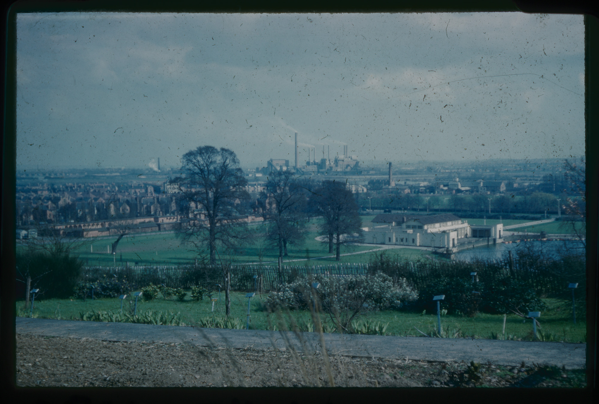
1960, from Keighton Hill
Please click on image to enlarge
At this time in a normal year people might wander from work to Keighton Hill, happy for a chance to leave the building, to take some lunchtime sun, to look over the city. The viewpoint is recognisable from this 1960 slide, taken from what was then the university Botanic Garden, but the components of the view are very different. In the distance Wilford power station smokes by the Trent, part of an industrial Nottingham since diminished; it disappeared from view in 1981, the site now the Riverside Retail Park. The University Park lake is visible, with the Lakeside Pavilion, venue for dances and concerts constructed when the campus and Highfields Park were laid out in the 1920s, at its eastern end. The Pavilion disappeared around the millennium; the current Lakeside arts centre opened in 2001. To the left of the slide is Highfields Lido, an Italianate open-air swimming pool, 330 x 75 feet, opened in 1924 and designed by Morley Horder, also architect of the Trent Building. The lido closed in 1981, standing derelict for a few years (it was possible to climb in, but the water was gone) before replacement in the 1990s by the Djanogly art gallery and the music department. The slide catches a mid-twentieth century landscape of public leisure and publicly owned industry, shaped by the local authority and Central Electricity Generating Board. Until a few weeks ago, the idea that the state might again achieve such a commanding presence seemed unlikely. Today’s view is underwritten by state support, though with prospects uncertain.
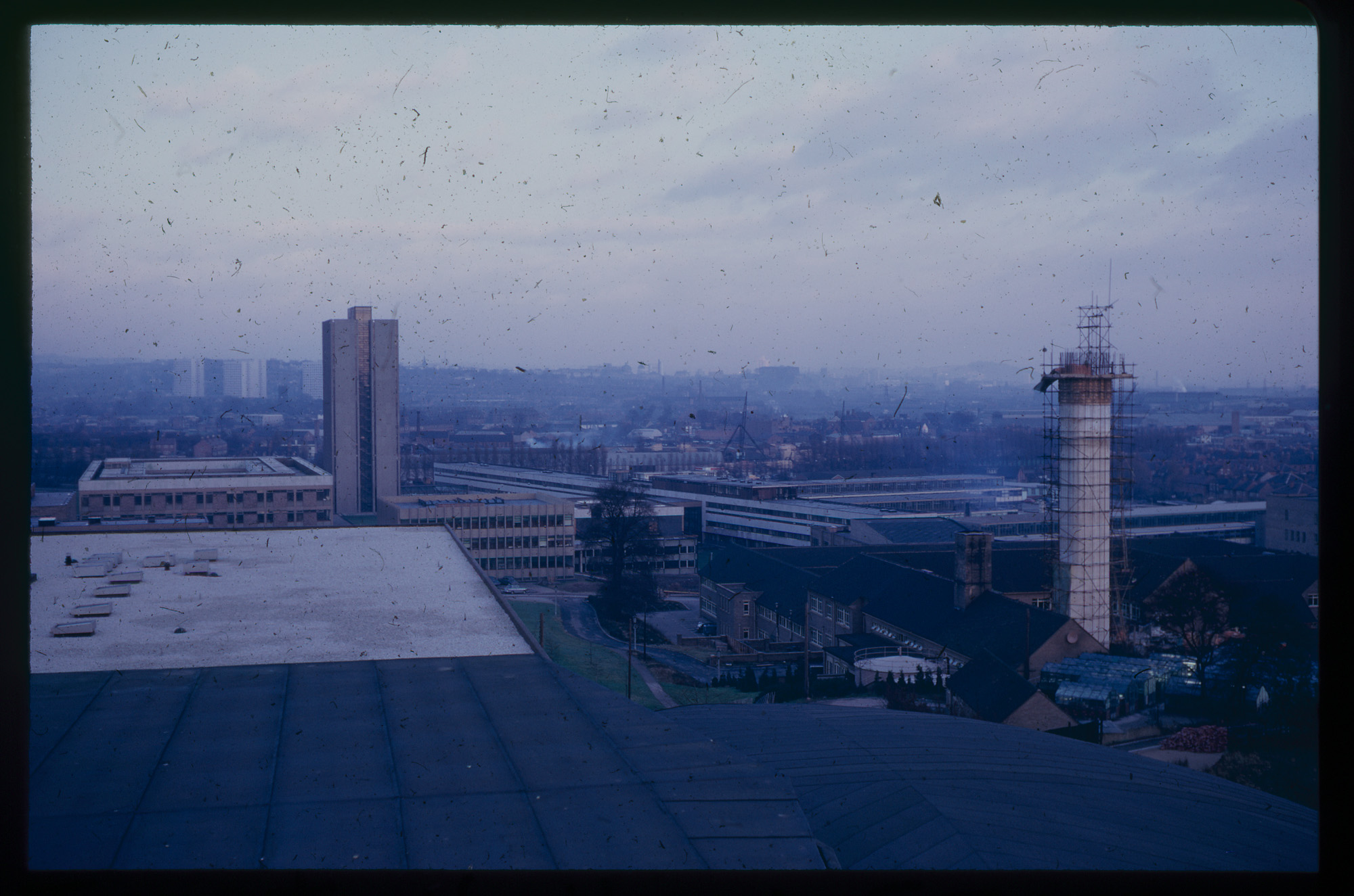
1968, from the Roof
Please click on the image to enlarge
The new Social Sciences building (now the Clive Granger Building) opened in 1967, housing the departments of geography, economics and sociology. In January 1968 someone took this view from the roof, showing a new university and city rising. The part of campus which would be colloquially known as ‘Science City’ is there, with the George Green Library and the ‘Architecture Tower’, then housing the department of architecture and in its design an expression of institutional modernity. The boiler house chimney climbs in construction. Absent for now is the Medical School, with Queens Medical Centre only built a few years later, opening in 1977. Zooming in shows Lenton Church, its tower visible between the new tower block flats off Derby Road, completed in 1967 and the sign of a housing future, which would last just over forty years. The Lenton flats were demolished from 2013. A zoom also allows inspection of the skyline, the dome of the Council House in Market Square visible, explaining why its loud ‘Little John’ bell is audible on campus, given an east wind.
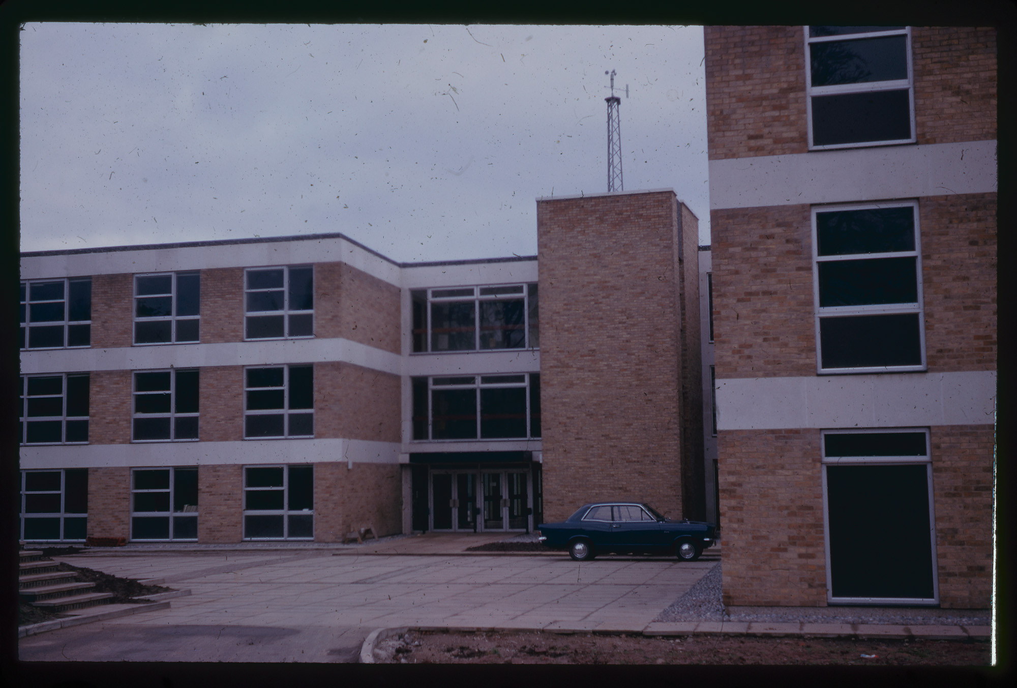
At Christmas, 1967
Please click on the image to enlarge
This view of the Social Sciences building entrance is dated ‘Christmas 1967’. Perhaps someone chose to escape domestic festive confinement to visit the office. The car may be the photographer’s, driven right to the door, no bollards obstructing. The bare soil in the foreground awaits planting, but otherwise the scene is largely familiar. The front doors, locked for the season, are of a style now surviving only at the permanently locked ground floor entrance facing Hugh Stewart Hall. Zooming in suggests a full top floor noticeboard. The roof shows the weather station, where daily readings would be collected for decades.
Any reader who has studied or worked in this building will have memories of daily entry and exit, whether through key-locked doors or the automatic doors installed around forty years after this image was captured. Any current worker or student will for now only have memories. The unpopulated Christmas 1967 view matches today. For the building, at present, every day is like Christmas.
No comments yet, fill out a comment to be the first
Leave a Reply