June 1, 2021, by lzzeb
Broad Marsh before The Broadmarsh
A blog by David Beckingham.
Sitting between the railway station and the central areas of the city, the site of Nottingham’s former Broadmarsh Shopping Centre is a large and strategic one. The COVID-19 pandemic and the collapse of the centre’s operator intu forced the abandonment of approved redevelopment plans before they could be completed. There is now an opportunity to consider different options for the site [1].
The City Council has now secured funding to progress with demolition work [1]. A microcosm of questions about the future of many high streets and city centres, the task of deciding what to do with the site has attracted mainstream media attention from the BBC and New York Times [2]. For the practical question of what to construct from the ruins of a 1970s retail dream is also an opportunity to imagine what kind of city we might want to live in. A council consultation recently attracted record numbers of responses from members of the public [3].
Imagining alternatives can involve looking at the past, returning to old plans for the future. This blog considers two maps and a photograph from the School of Geography’s extensive collections. These show changes to the area in the period before the city street known as Broad Marsh was redeveloped into the Broadmarsh Shopping Centre.
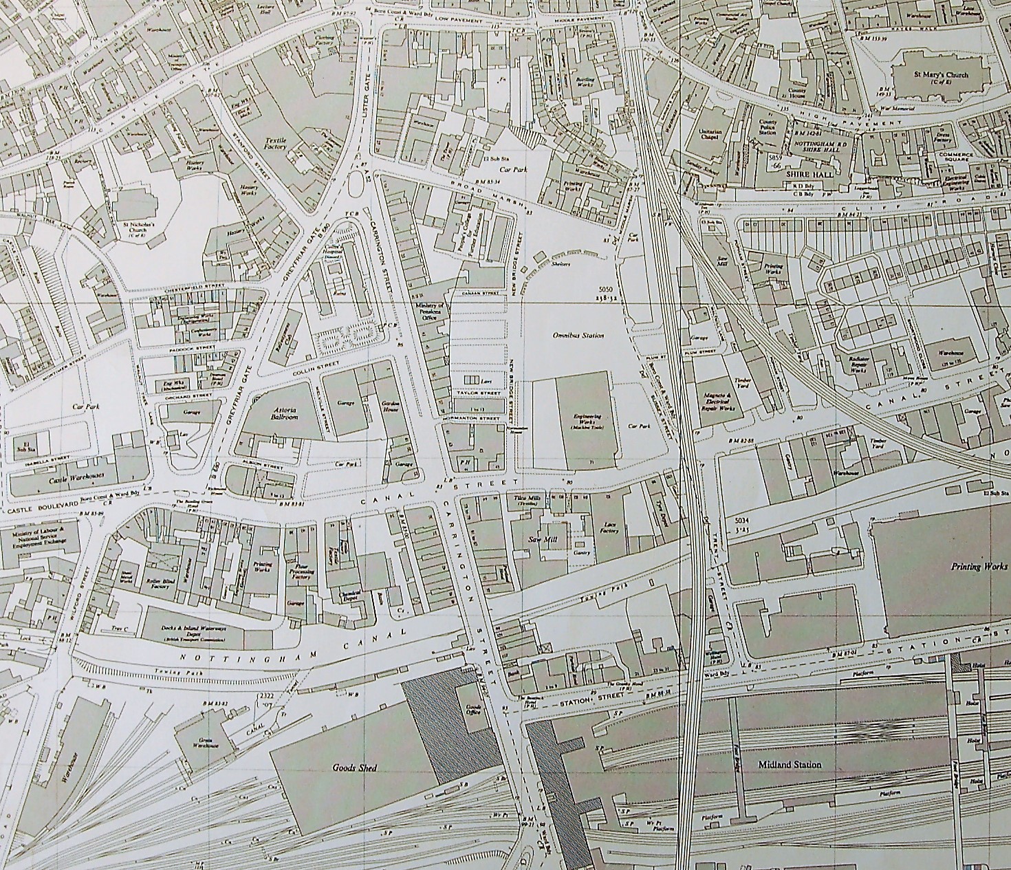
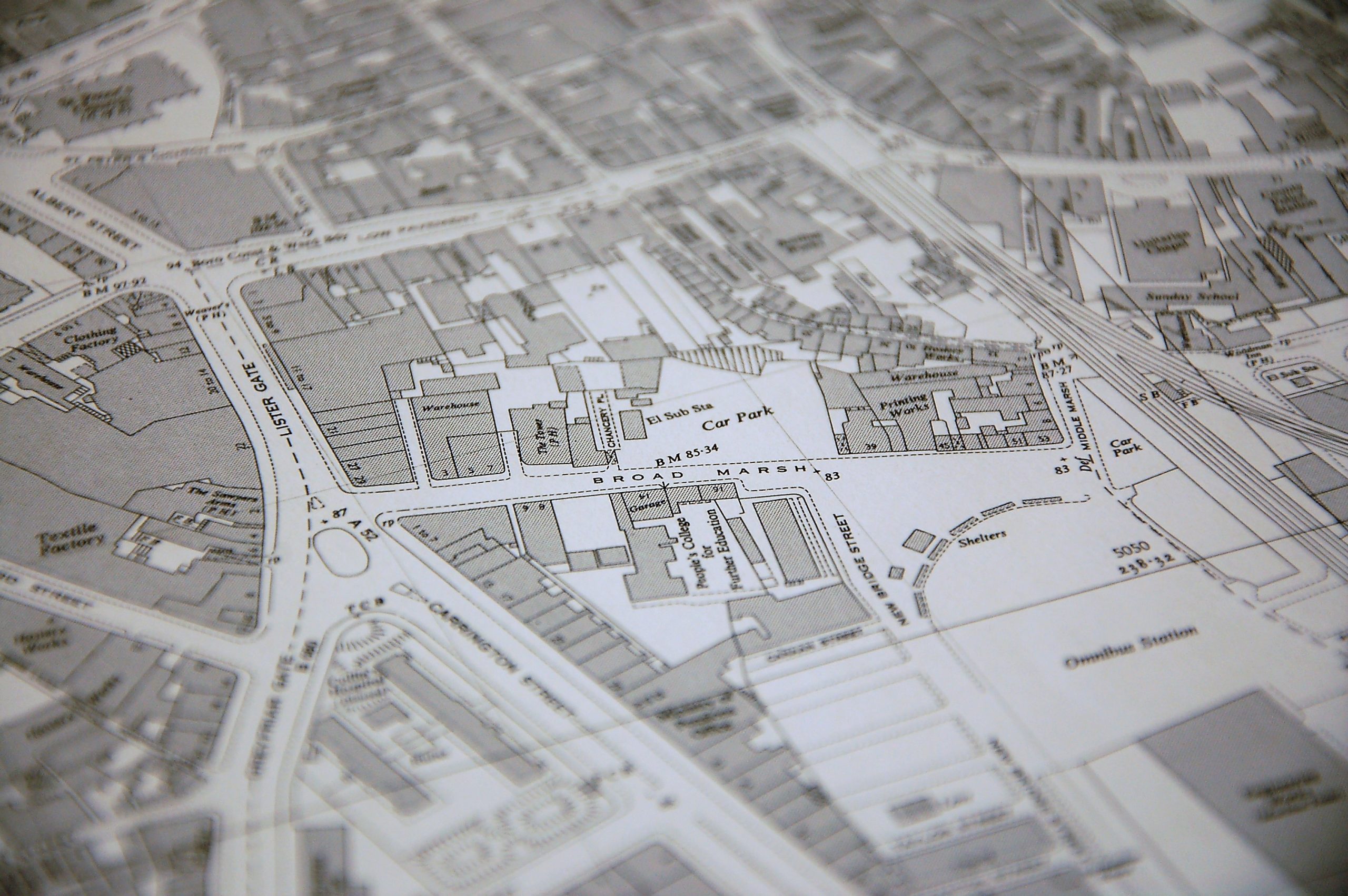
Figure One (and title image), Ordnance Survey Plan SK5739, 1955, 1: 2500 (School of Geography Map Collection). Click to enlarge.
Figure One is drawn from an Ordnance Survey map published in 1955, with revisions up to 1953. It is notable the extent to which infrastructure and industry shaped this area of the city. The Nottingham canal moved east west across this area of the city, passing warehouses, factories and printing works on its way to the River Trent. The extensivity of railway operations can also be seen. These include the fan-like sidings and sheds west of the Midland Station, and the line of the old Great Central Railway that carried passengers northwards into a tunnel beneath Weekday Cross and on to the city’s Victoria Station (itself later redeveloped as a shopping centre).
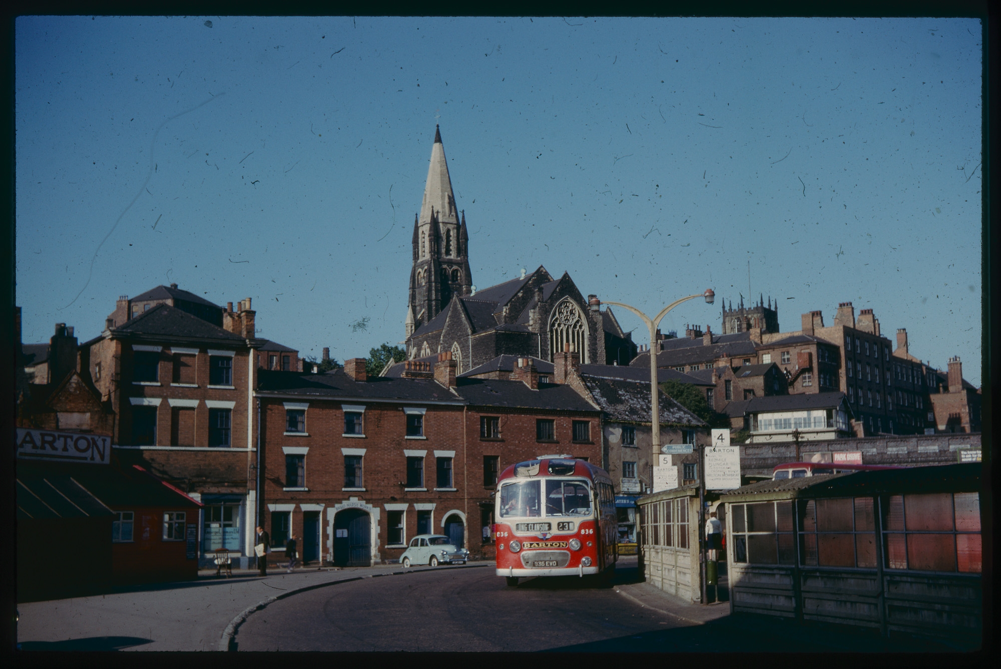
Figure Two, Bus station and Broad Marsh (undated photograph from School of Geography archive)
Figure Two is from a set of slides in the School’s archive, which were kindly digitised in 2020 as part of a placement project at the university’s Manuscripts and Special Collections department. Though we do not know the photographer, or precisely when it was taken, the image captures a view looking north-east from New Bridge Street. It shows a number 23 Barton bus – destined for Long Clawson in the Vale of Belvoir – and buildings fronting the eastern end of Broad Marsh. These can be seen on Figure Three, an Ordnance Survey map published in 1965 based on revisions up to 1963. I have included an indicative though imprecise outline of the area affected by the shopping centre development [3]. It emphasises how the development interrupted existing street patterns. Pedestrian visitors to Nottingham would be forced through the shopping centre.
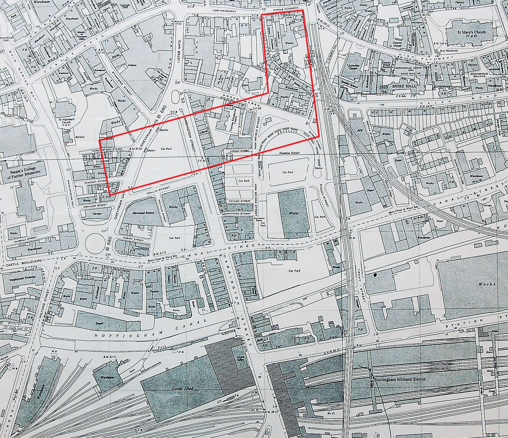
Figure Three, Ordnance Survey Plan SK5639 and 5739, 1965, 1: 2500 (School of Geography Map Collection). Click to enlarge.
A railway signal box can also be seen on the centre right of the photograph. It guarded the junction of the former Great Central and Great Northern lines. The Unitarian Chapel of High Pavement that dominates the photograph gives a sense of the height changes that the shopping centre architects needed to accommodate in their plans. The spot heights on the map show a gain of nearly forty feet from the bus gyratory, up Middle Marsh and Drury Hill, to Middle Pavement.
Rather than buses and trains, it is the infrastructure of the motor car that marks one of the main differences between the 1955 and 1965 maps. Maid Marian Way is marked, though not yet the elevated concrete carpark that would be projected across its approach to Collin Street at the southwest corner of the Broadmarsh centre. Education is also prominent in the area, with the People’s College of Further Education a large new edition on the western edge.
Looking at the themes of these maps, infrastructure and education are to the fore in today’s redevelopments in the area: these include a newly opened Nottingham College campus and a large library, car park and bus station complex also nearing completion. Trams also connect the railway station and the city centre, their elevated route affording views of the remains of Broadmarsh.
References
[1] My Nottingham News, Nottingham City Council, ‘Demolition of part of the former Broadmarsh Shopping Centre to begin in June’, 26 May 2021, https://www.mynottinghamnews.co.uk/demolition-of-part-of-the-former-broadmarsh-shopping-centre-to-begin-in-june/
[2] BBC News online, ‘Shopping centres face demolition after Covid’, 21 May 2021, https://www.bbc.co.uk/news/av/uk-57165171; Stephen Castle, ‘Nottingham’s Dilemma: Robin Hood or high tech?’ New York Times online, 16 May 2021, https://www.nytimes.com/2021/05/18/world/europe/nottingham-broadmarsh-centre.html
[3] For old images and maps, and an accurate outline of the area being redeveloped, see Nottingham City Council: Broadmarsh: The Big Conversation:
https://storymaps.arcgis.com/stories/21c59c2e9c52410b9278230ea7828acc
No comments yet, fill out a comment to be the first
Leave a Reply