October 3, 2019, by lzzeb
Pakistan, India and mapping the contested accession of South Asia’s princely states
A blog by Philip Jagessar
Earlier this year the government of India controversially revoked article 370 of the constitution which had given the long disputed state of Jammu and Kashmir a degree of autonomy from the rest of India. Pakistan loudly protested this unilateral move by India and rising tensions have revived fears of a fourth war between the two countries over the restive region of Kashmir.
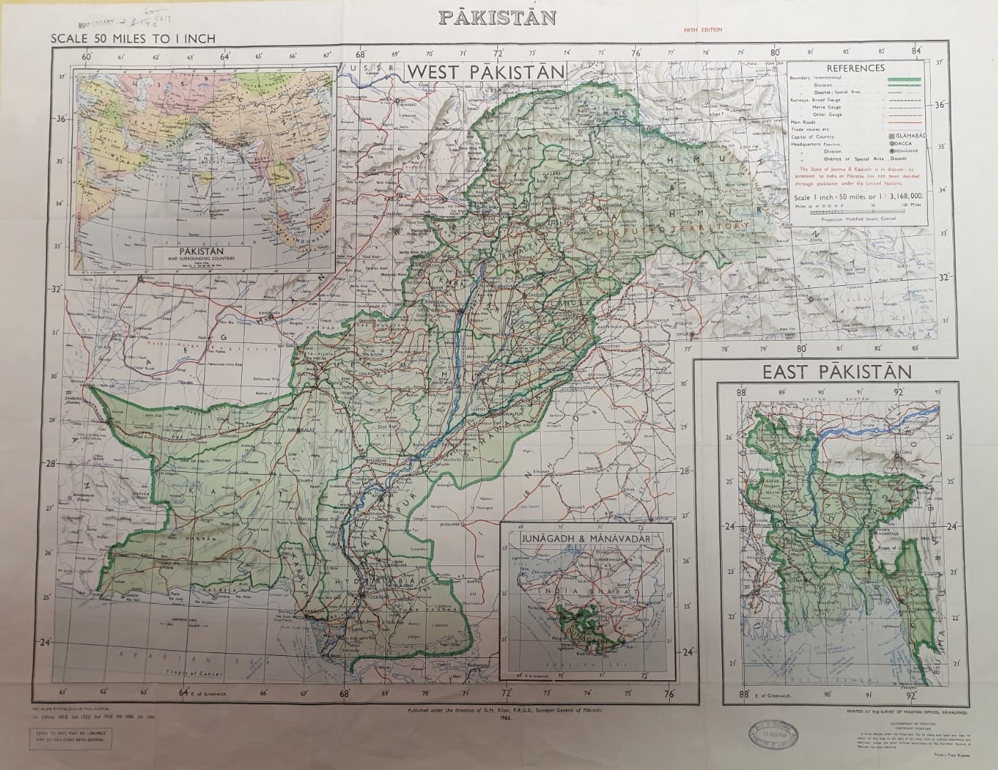
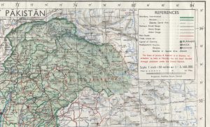
The above map, from the Geography department map collection, is a good example of how the disputed region of Kashmir has often been depicted on maps published in Pakistan. This is the 1966, fifth edition of the 1950 map of Pakistan published by the Survey of Pakistan. Kashmir is presented as an integral part of the nation with only its eastern boundary undefined. The description ‘disputed territory’ remains faint and indistinct on the green background, the colour commonly used to map Pakistan before and after independence.
The origins of the Kashmir dispute, which both Pakistan and India claim to be rightfully theirs, can be traced back to British rule in India. India was not a unified state but a patchwork of directly ruled provinces, which formed British India, and princely or ‘native’ states who retained a degree of independence under British suzerainty. Jammu and Kashmir was one of the largest of these princely states situated in the foothills of the Himalayas. However, as British rule was ending the question of what would happen to these princely states became uncertain as they had direct treaties with the British Sovereign and could not be partitioned to either India or Pakistan. The 1935 Government of India Act left room for what became known as the Instrument of Accession which allowed the princely states to decide themselves whether they would accede to India, Pakistan or remain independent. Realistically, however, most princely states were pressured or chose to accede to either India or Pakistan.
The princely state of Jammu and Kashmir, under the rule of Maharaja Hari Singh, initially tried to maintain independence in 1947. Kashmir was a predominantly Muslim state but the ruling dynasty, and a large minority, were Hindu so Hari Singh saw independence as the only alternative option to his preferred choice of acceding to India. Pakistan tried to force the issue by fomenting unrest and tacitly supporting an invasion by Pashtun tribesmen. The Maharaja decided to accede to India in return for Indian support to repel the invaders, leading to the first Indo-Pakistan war in 1947. After the war ended, part of Jammu and Kashmir remained under Pakistani control as Azad Kashmir with the rest of the region disputed. As the map legend reminds the reader, the UN, who helped mediate the conflict, proposed in Security Council Resolution 47 that a plebiscite should be held in Kashmir to determine the wishes of the people. At the time this map was published in 1966 it had not been held nor has it been held since. Kashmir will remain a contested region, on the ground and on the map, for the foreseeable future.
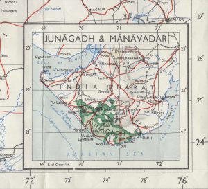
What is unusual about this map isn’t that the Survey of Pakistan has chosen to map Kashmir as part of Pakistan. The Survey of India has done the same for India. It is the inclusion of the small inset map showing Junagadh and Manavadar as part of Pakistan. These former princely states were situated on the Kathiawar peninsula of Gujarat, over two hundred miles south east of the Pakistan border. The contentious accession of Junagadh State may appear modest, with less far-reaching consequences, than that of Jammu and Kashmir but sums up the territorial machinations of Pakistan and India after partition.
Similar to Jammu and Kashmir, Junagadh was a predominantly Hindu princely state ruled by a Muslim Pashtun dynasty. The last Nawab, Muhammad Mahabat Khanji III, acceded to Pakistan in 1947 against the wishes of Lord Mountbatten and others who contended that geographical contiguity was most important. Junagadh’s accession to Pakistan was argued on the grounds that it was connected to Karachi via a short sea journey. India declared the accession invalid because Junagadh was surrounded by states that had joined India and in the interests of the predominantly Hindu population. The Indian army blockaded the state and, parallel to Pakistan’s actions in Kashmir, invaded the outlying areas of Junagadh State. India eventually took control of Junagadh after the Nawab fled to Pakistan. Unlike what happened in Kashmir, India held a non-UN sanctioned plebiscite in Junagadh and surrounding areas who overwhelmingly voted to accede to India. Pakistan maintained that the original Instrument of Accession had been legitimate, bringing the issue to the UN in 1948. The Junagadh dispute was attached to the commission looking into the Kashmir dispute however they never reported on it and the dispute has not, theoretically, been settled.
The fifth edition, 1 inch to 50 mile, map of Pakistan is an example of irredentist cartography, reclaiming Junagadh – and Kashmir – “on the map” and keeping the dispute alive through the continued reprinting of the original 1950 edition. It is somewhat ironic then that only six years later, in 1971, East Pakistan would be lost from the map after Bangladesh declared independence and seceded from the union.
Further reading
Rakesh Ankit. ‘The accession of Junagadh, 1947–48: Colonial sovereignty, state violence and post-independence India.’ The Indian Economic & Social History Review, 53:3 (2016) 371–404.
Yaqoob Khan Bangash. A Princely Affair: The Accession and Integration of the Princely States of Pakistan, 1947-1955 (Oxford: Oxford University Press, 2015).
No comments yet, fill out a comment to be the first


Leave a Reply