« return to post
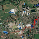
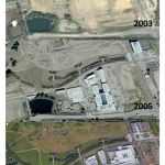
Figure4

Figure 4 Old OS maps and an aerial image from maps.nls.uk. Maps are overlaid with the course of the Caroline Burn.
Images of old OS maps and an aerial image from maps.nls.uk. Maps are overlaid with the course of the Caroline Burn.