« return to post
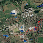
Figure3
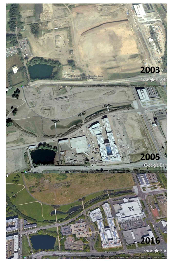
Figure 3 Google Earth Aerial images of the Granton Ponds
Google Earth Aerial images of the Granton Ponds
Figure 3 Google Earth Aerial images of the Granton Ponds
Google Earth Aerial images of the Granton Ponds