October 3, 2013, by Blue-Green team
35th IAHR World Congress, Chengdu, China
In September, Prof. Nigel Wright, Dr Scott Arthur and Deonie Allen of the Blue-Green Cities team attended the 35th IAHR conference held in Chengdu, China. Over 1500 specialists from around the globe presented on 8 key areas of water and riparian engineering and science.
Dr Arthur presented the research he has recently supervised (undertaken within Heriot-Watt University by Dr Janice Blanc) looking into the intricacies of trash screen or grate design. Flume experiments were used to analyse the Froude number, screen angle, distance from culvert, bar spacing and design were analysed in a steady flow environment. The results were presented in a draft advisory report to the Construction Industry Research and Information Association(CIRIA) as well as a nomograph to assist in effective screen design in the future.
Deonie Allen’s presentation described the proof of concept field work to enable accurate and meaningful debris residency and transportation data collection from small urban watercourses. Passive integrated transponder (PIT) tags were used to monitor debris transport and travel time within an urban stream. Residency was collated with point flow characteristics and solute time of travel to identify the relationship between these key variables. Field data analysis enabled the key parameters influencing small woody debris movement in an urban watercourse to be identifies and the relationships between these to be explored. This forms part of WP2b in the Blue-Green Cities project.
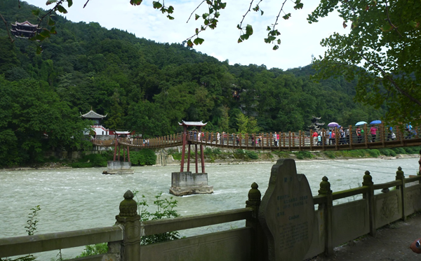
Chengdu is a city of 14 million people, fed through the bounty of the Yangtze River catchment. The city was an ideal location for the conference, situated in an area influenced by landslides and flooding, and a history of significant infrastructure to manage these risks. The Min River flows from the upper reached of the catchment through to the Chengdu plains, supporting the population but also historically caused severe flooding. In 256 BC the Dujiangyan Irrigation Project was constructed, creating a levee and 20 m wide irrigation channel to feed the downstream agricultural areas and provide flood alleviation to the downstream population.

The ‘fish head’: the upstream point of the diversion island where the man-made channel (right) is diverted from the main river (left)
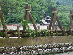
The irrigation channel, central island (the fish) and sediment separation and collection system still function as originally designed. While the original woven bamboo gabions and wooden tripods are annually replaces and some areas have incorporated modern building materials, the channel cross sections have been maintained. Over 2000 years ago, Li Bing constructed a channel and levee system that naturally controlled low flow and separated extreme flood flows without the use of gates. In conjunction with this, two main sediment deposition zones were created to manage the water quality and sedimentation of downstream reaches, effectively separating the boulder from the sand and depositing large proportions of these at predetermined locations in the irrigation reach. This still functions today.
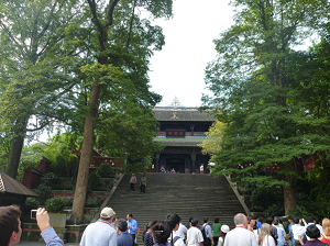
To help protect the Dujiangyan irrigation system from damage, a temple has been built on the island separating the irrigation channel from the main river. It is believed that the temple is situated on the home of the flood dragon, the cause of extreme flooding. The temple, surrounded by an ornate bonsai garden, has trapped the dragon in the ground, preventing it from causing regular extreme flooding and harm to this catchment.

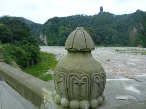
Sediment deposition zone alongside the constructed channel, River Min. This is cleared of sediment every year
Blog post by Deonie Allen, Heriot-Watt University.
Check out the Blue-Green Cities website to see future conferences our team will attend.
No comments yet, fill out a comment to be the first


Leave a Reply