
September 20, 2013, by Blue-Green team
Piloting Bayesian Networks as a technique for the participatory modelling of flood risk in Hebden Bridge, West Yorkshire
Part I: Background to the project, and the first three workshops (by Shaun Maskrey)
Traditionally, flood risk management in the UK has relied on the technical fix, an engineered solution parachuted in by certified experts who may or may not have local knowledge of the catchment. This has led to a dominance of engineered grey infrastructure (flood walls, embankments, etc…) and a public expectation that if we spend enough money, there is a solution out there that will stop flooding for good.
The sustainability of this way of thinking is increasingly being challenged, and it is being recognised that increasing flood resilience is key to decreasing flood risk. The local knowledge and expertise that stakeholders can bring to the decision-making table is increasingly being valued as complementary to that of the traditional ‘experts’. Public participation is written into UK and European legislation, which goes beyond mere consultation, to promote the ‘active involvement’ of stakeholders in decisions about flood risk (Water Framework Directive, 2000).
Involving stakeholders at the beginning of the process is essential to developing successful participation, and often this means that the stakeholders will be at the modelling table, where their understanding of the catchment under a range of different conditions will be invaluable to ensuring that solutions are tailored to local expectations and means. It is however, a big step from saying that they should participate, to saying how they should participate. There is no handbook or set of instructions to follow, and that is where this project comes in.
The project
A project is underway in Hebden Bridge, West Yorkshire to develop and pilot a methodology to involve stakeholders in modelling a local catchment, and embed their local knowledge and understanding into flood risk decision-making.
Hebden Bridge is a rural market town with a population of 4,500 situated nine miles to the west of Halifax. It is in the steep sided Upper Calder Valley, which drains from the peat moorlands of the South Pennines. The town has a history of frequent and devastating flood events, the most recent in the summer of 2012. River levels and surface runoff respond quickly to changes in catchment conditions, and flash flooding poses significant concern as intense rainfall events become more common. The town, alike to many in the area, has no flood defences, because poor cost-benefit ratios have meant that past flood alleviation schemes have not gotten off the ground. With tourism and retail as the main sources of income for many of its businesses, people are wary of the aesthetic effect of concrete flood defences similar to those recently completed in neighbouring Todmorden. As a result, residents, organisations and the Environment Agency alike are looking for novel solutions to this complex problem.
With local residents keen to test out novel solutions and flooding so high on the public agenda, this seemed like the ideal candidate for a pilot project to develop a methodology for involving stakeholders in modelling their own flood risk. So, roughly following a methodology laid out by Jeremy Cain (2001), stakeholders are building a Bayesian network that represents their understanding of how the environmental system operates in the Hebden Water sub-catchment, and will use this to test what interventions have the greatest probability of positively affecting their catchment objectives.
Prior to the first modelling workshop, ten of the stakeholders were interviewed, either individually or in pairs, to establish a range of objectives for the catchment. Following each interview, the list of catchment objectives were then refined prior to the next. This iterative process of review and update helped to ensure that by the time of the first modelling workshop, the objectives reflected a range of stakeholder views and aspirations for the catchment
Workshop one
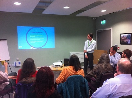
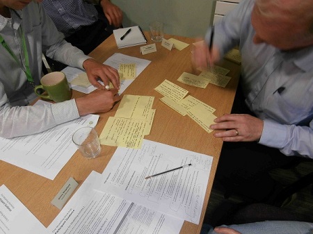
Introductory presentations reiterated the objectives for the pilot, the methodology we were embarking on and introduced Bayesian networks for the first time. For the main modelling activity, the stakeholders were split into two smaller groups to discuss each of the catchment objectives in turn, to identify: a) the actions that could be taken to achieve the objective, b) factors that affect whether these interventions are going to be successful, and c) any factors that lie between each intervention and the objective they are trying to achieve. All of these were written onto separate cards and became the system variables.
Workshop two
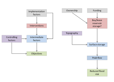
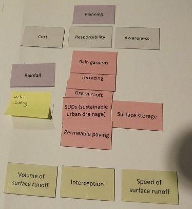
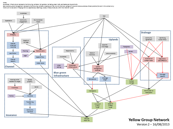
Two groups, as similar in makeup to the first workshop as possible, were given the full set of variables and were tasked with arranging them into the network structure as per the worked example below. Facilitation was provided in prompting the stakeholders with key questions such as ‘What are the causes of x?’ and ‘What interventions could be put into place to achieve x?’.
An example of an initial network structure developed by one of the groups is provided below.
Workshop three
At the third workshop, stakeholders saw the network structures for the first time, and were able to check whether they correctly represented their understanding of how the catchment operates. By taking each node in turn, they first looked at the list of variables which fed into it, and asked of each “Does variable x directly affect the variable of interest?” Second, they looked elsewhere in the network, to check if any variables had been missed out of this list. These checks allowed the stakeholders to iteratively refine the model, so that it more closely represented their understanding. Comments from stakeholders after the workshop would suggest that spending time on this activity increased their trust and ownership of the model.
Next steps
Over the next three weeks, I will meet with colleagues at the Environment Agency to streamline and combine the two group networks, taking the best bits from both, and making sure that there is the least amount of duplication. Merging the networks will halve the workload at future workshops, as the groups can work on small bits of the network and hopefully cover more ground in less time.
At the next workshop, the fourth in the series, we will define states for each of the variables. These are the conditions that they can be in, and allow us to see, when we test the network, what probability they have of changing states based on our interventions.
The next blog in this series will follow the progress of this exciting pilot project through its future workshops and events.
Read the eBulletins that document Shaun’s research at Hebden Bridge on the Blue-Green Cities website
No comments yet, fill out a comment to be the first

Leave a Reply