January 19, 2015, by Emma Thorne
Countryfile appearance for Lakeland research project
A University of Nottingham research project to explore the first ‘mathematically accurate’ 3D relief model of the Lake District was featured on this week’s Countryfile.
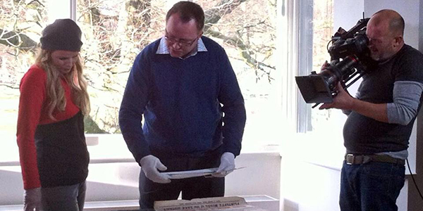
Shown on BBC 1 on Sunday evening, the programme saw presenter Ellie Harrison travel to Keswick to meet Dr Gary Priestnall from the University’s School of Geography whose work around the Mayson model has spawned a new exhibition due to open at the beginning of February.
His work has focused on what is believed to be the one last surviving, beautifully hand-painted piece of the 15-foot square model, as well as 140 of the original plaster moulds used to create it.
Photographer Henry Mayson and his brother Thomas who commissioned the model from sculptor Raffaele Monti came up with the perfect Unique Selling Point for their attraction. Visitors flooding into the area from the newly constructed railway were told that it was the most accurate 3D representation of the landscape they were likely to see, and that it was faithful to the relatively new Ordnance Survey maps which had become de rigueur.
The model, which included intricate details of the landscape in a six inch to one mile scale, was housed in the Maysons’ photographic studio on Lake Road, Keswick, which was becoming a major gateway to the Lake District for the rest of the UK during the emergence of Victorian tourism. At a time when maps and travel guides were expensive and aimed largely at wealthy travellers, the Mayson model became the first stop for people arriving from large industrial cities like Manchester and Glasgow so they could plan their itineraries and walking tours.
Dr Priestnall has worked with Dr Katharina Lorenz at the University’s Digital Humanities Centre to digitally capture the moulds using a high-precision laser scanner. These laser ‘point clouds’ were then processed and digitally inverted using a Geographical Information system (GIS) within the School of Geography. Next, a team at the University’s Centre for 3-D Design led by Sarah Thomas used the detailed digital data and the latest milling technology to produce authentic blank replicas of the some of the model’s tiles.
The results will be on show at a new exhibition which will be unveiled on Monday 9th February at Keswick Museum and Art Gallery. The exhibition has been created by Dr Priestnall in collaboration with the museum’s Curator Sue Mackay and is being run in partnership with Ordnance Survey.
It will feature the opportunity to see the last remaining original tile, the original Ordnance Survey maps used to create the model, and many of the posters used to advertise the model. Also, a floor map of the Lake District at the scale of the original model will place several digitally reconstructed replica pieces into context, raised above the floor map on plinths. Modern technology will also be used to project a series of layers of different types of maps, imagery and animation onto a larger section of replica model to give a sense of the developments in land cover mapping since Victorian times.
Bringing the story right up to date, a thrilling virtual ride over the Lakes will be provided by modern digital modelling techniques constructed from current Ordnance Survey data.
This week’s episode of Countryfile can be watched again on the BBC iPlayer.
- Picture courtesy of Keswick Museum and Art Gallery.
No comments yet, fill out a comment to be the first


Leave a Reply