May 8, 2019, by Sarah Colborne
War work in the water archives
This is a guest post by Geography student placement Natalia O’Cleirigh
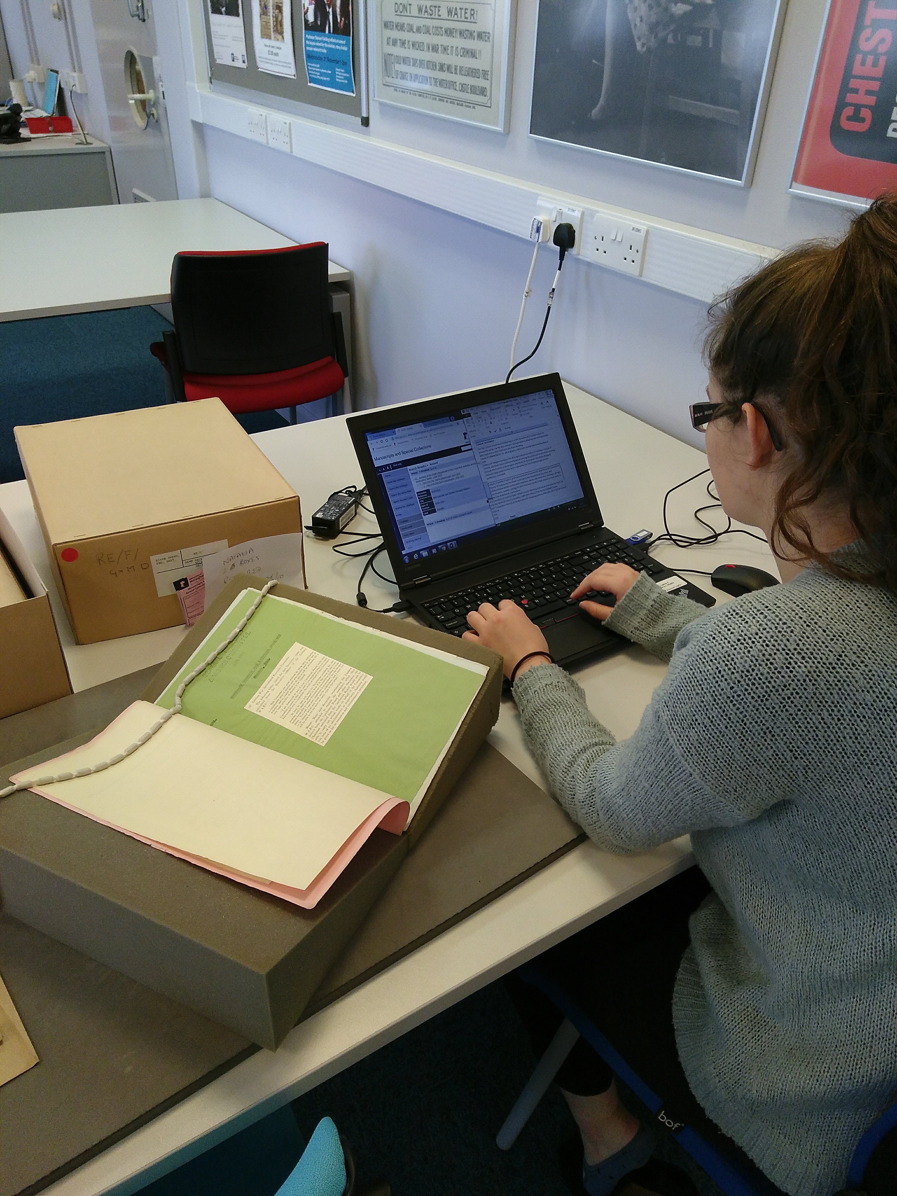
Student placement Natalia O’Cleirigh working on the records of the River Trent Catchment Board
The University of Nottingham Manuscripts and Special Collections holds a collection of resources from the River Trent Catchment Board. I was tasked with cataloguing a section of the archive as part of my placement which focused on the Engineers’ files. The organisation was responsible for the drainage and flooding of land in the River Trent catchment areas until 1951. This archive held by the University of Nottingham includes documents, minutes, graphs, maps and photographs from a range of events within the Board including floods, scheme developments, and files from departments such as the Clerk’s office, Engineers’ files, Governance records, Hydrology and water resources and the Treasury. I was tasked with adding information to the catalogue for files within the Engineers’ office section of the archive. This contained letters, reports and memorandums between internal departments concerned with different regions of the catchment, as well as communications with the Ministry for Agriculture and Fisheries, farmers, other water boards and suppliers. I was interested in files from 1939-1948 because they included a story from World War II that is unknown. This is a period of history that interests me and is well known to the public. However, I felt that cataloguing files from this period would highlight the contributions of local Boards and individuals on the Home Front, providing an insight into the war which is not well known to the public. Furthermore, the files demonstrate the communications between Government and local boards which illustrates the concerns of the Government at the time. The requests from Government and the activities of the River Trent Catchment Board show how the tides of war changed the policies of the Ministry of Agriculture and Fisheries to support the war effort.
I started by cataloguing files on land drainage projects as part of the War Agricultural Scheme. This involved clearing plant life and dredging drains passing through agricultural land so land that was previously unviable for agricultural use could be used as pastureland, leaving the good pastureland for arable crops. This was rampant during 1941- 42 in order to increase food production during the Battle of the Atlantic. An example of the War Agriculture Scheme can be seen at Hell Brook in Derbyshire where the brook was cleared to help drain 562 acres. The project, which began on 19th December 1940 dredged and sludged the brook as well as clearing weeds, plant growth and trees at a cost of £5.6 per acre using the labour of one excavator driver and ten unskilled, unemployed miners. Further information on the scheme can be seen in RE/F/G&M/D4A/5. The Ministry of Agriculture and Fisheries split the costs with land owners (see RE/F/G&M/ D4/2 for further information). Whilst modern river management today would deem this scheme undesirable in the long run, it enabled 2,500,000 acres of pasture land to be ploughed for crops at a time when food was increasingly scarce. In the River Trent catchment 52 of the proposed 53 drainage schemes were completed.
I also catalogued files containing information on the River Trent Catchment Board’s air raid precautions. This included measures to protect the board’s buildings as well as its infrastructure on rivers. In total the Board spent £12,150 on air raid precautions with included the purchased 600,000 sand bags and 10,500 cubic feet of timber for emergency sluices. As you can see on the map which was reused to show flood damage, the supplies were deposited in stores along the banks of the River Trent. Volunteer gangs of local farmers patrolled sections of the river at night during air raids to minimise the damage caused by a bomb hitting the river. Letters organising the patrol groups are kept in the archive.
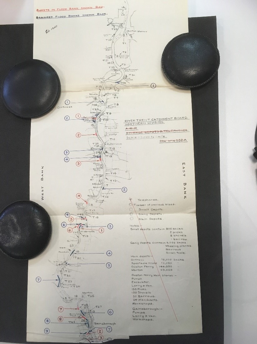
Engineers’ Department map of a stretch of the River Trent, showing storage depots, later reused to show flood damage.
The archive held at King’s Meadow Campus includes requests for information in case of an Nazi invasion. The military requested information on where troops could land, passable bridges, how to flood lock and sluice gates and the immobilisation of boats within the catchment. This information was given by the River Trent Catchment Board, alongside assistance to the Home Guard. I catalogued correspondence between the local Home Guard and the Board which identified the key Board employees who could not be released for military service in the case of an invasion as well as access to the Board’s boats and stores. As the tide of the war turned, the military began to request access to the river banks to practice river crossing exercises, the preparations for which can be seen in the images below.
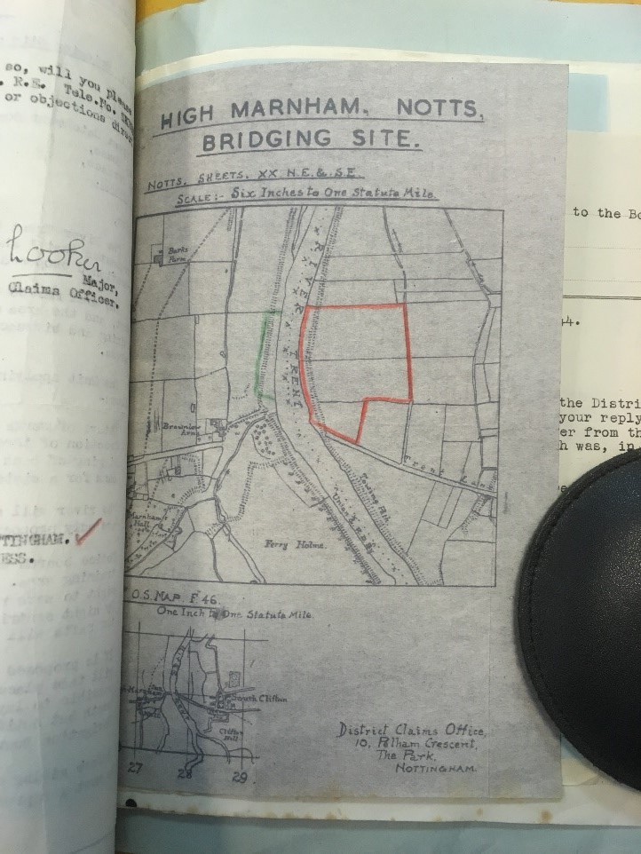
River Trent Catchment Board map showing site to be used by the army for bridging exercises.
Nearing the end of my placement, I catalogued the Board memorandums and newspaper articles regarding River Trent flooding events in the 1950s. The files mainly highlighted the success of the drainage projects, with positive reviews from local residents and newspapers. This neatly brought me placement to an end as the War Agricultural Scheme played a role in the successful drainage of farmland which flooded before the war. Throughout my time processing the documents, I especially enjoyed files on Air Raid Precautions which showed how a drainage Board adapted to a wartime role. Furthermore, the coordination between the Board, the Government, local farmers and businesses gave a fascinating insight into 1940s life. My cataloguing highlighted how life in Nottinghamshire has evolved from the bombing raid patrols on the county’s rivers and coordination of the Home Guard’s response to an invasion. However, the interactions starkly demonstrated the similarity of lives decades apart. Whilst, the technology has evolved, the fundamental nature of communication between Government, local businesses and individuals is very similar. Seeing recognisable place names in maps of the Trent and agricultural schemes around Nottinghamshire made me aware of the connections from the archive and the Nottinghamshire of the modern day. This experience reinforced for me the ongoing relevance of archives.
Further information about the water related archives held by Manuscripts and Special Collections is available on their website, and the files and other records can be accessed in the Reading Room at King’s Meadow Campus. Manuscripts and Special Collections offers several placements each year to students who are interested in working with archives, or who may be seeking work experience for a potential career in the heritage sector.


Excellent information and i had no idea this work went on. Surprising what went on in the war that we never hear about. The Nottingham home guard are real heroes in my my eyes. Thank you for bringing this to my attention.
Quite interesting information. It is good to know this kind of history that is so easily forgotten or not known.