
March 6, 2013, by Graham Kendall
Drone demonstration over campus
The MEME project demonstrated one of their drones to the Department of Wildlife and National Parks Peninsular Malaysia recently (1st Mar 2013).
We were privileged to have four people from the Department of Wildlife and National Parks Peninsular Malaysia attend the demonstration, these being
- Dato’ Abd Rasid Samsudi – Director General, Department of Wildlife and National Parks Peninsular Malaysia
- Datuk Misliah Mohd Basir – Deputy Director General, Department of Wildlife and National Parks Peninsular Malaysia
- En Mohd Nawayai bin Yasak – Director of Biodiversity Conservation Division, Department of Wildlife and National Parks Peninsular Malaysia
- Dr Sivananthan Elagupillay – Director of Ecotourism Division, Department of Wildlife and National Parks Peninsular Malaysia
The demonstration showed what a drone could do, leading to a discussion on the current projects where the drones were providing valuable insights and data and also explored if there were any other uses for the drones.
The weather (I am told) was perfect for flying drones, albeit a little hot for those of us those remained on the ground!
As far as I could see the demonstration went very well, with the drone being launched, before climbing to 200m, at which point it followed a predetermined flight path by following a series of way points that it had to fly to.
The landing looked pretty perfect to me and I am told, by the team, that it was one of the best they had ever achieved. Not surprising I suppose, seeing as they had perfect weather conditions and a large flat field. Usually, they are trying to land in a jungle clearing in far from perfect weather conditions!
Below are some pictures from the demonstration, but many more are available here.
The gallery pictures show the people involved in setting up and watching (including the media team from the UK, who will also be reporting on this event) the demonstration, as well as pictures from the test flight.
If you look carefully at the gallery pictures from the flight you can see that they are time lapsed, with a picture being taken about every three seconds. This enables the team to stitch them together to produce one picture from the flight.
An example from a previous flight, over the campus, can be seen in a previous post on this blog (you can see all posts on drones here).
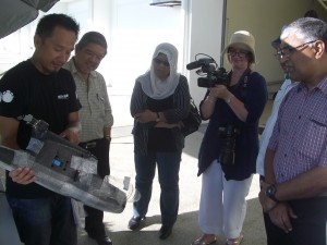
Explaining how the drone works
(left to right) Lim Wee Siong – MEME’s conservation drone specialist (Research Associate at UNMC); Dato’ Abd Rasid Samsudi – Director General, Department of Wildlife and National Parks Peninsular Malaysia; Datuk Misliah Mohd Basir – Deputy Director General, Department of Wildlife and National Parks Peninsular Malaysia; Lindsay Brooke (UoN Media Relations Manager; En Mohd Nawayai bin Yasak (almost hidden) – Director of Biodiversity Conservation Division, Department of Wildlife and National Parks Peninsular Malaysia; Dr Sivananthan Elagupillay – Director of Ecotourism Division, Department of Wildlife and National Parks Peninsular Malaysia
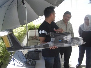
Explaining how the drone works
(left to right) Lim Wee Siong – MEME’s conservation drone specialist (Research Associate at UNMC); Dato’ Abd Rasid Samsudi – Director General, Department of Wildlife and National Parks Peninsular Malaysia; Datuk Misliah Mohd Basir – Deputy Director General, Department of Wildlife and National Parks Peninsular Malaysia
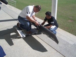
Putting the wings on
(left to right) Steven Lim – MEME’s Field Project Manager (Research Assistant at UNMC); Lim Wee Siong – MEME’s conservation drone specialist (Research Associate at UNMC)
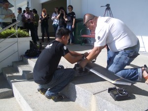
Getting ready for flight
(left to right) Lim Wee Siong – MEME’s conservation drone specialist (Research Associate at UNMC); Steven Lim – MEME’s Field Project Manager (Research Assistant at UNMC); and assorted on lookers!
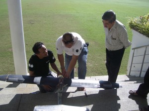
Pre-flight checks
(left to right): Lim Wee Siong – MEME’s conservation drone specialist (Research Associate at UNMC); Steven Lim – MEME’s Field Project Manager (Research Assistant at UNMC); Dato’ Abd Rasid Samsudi – Director General, Department of Wildlife and National Parks Peninsular Malaysia
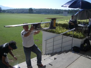
Making sure the drone is balanced
(left to right) Lim Wee Siong – MEME’s conservation drone specialist (Research Associate at UNMC); Steven Lim – MEME’s Field Project Manager (Research Assistant at UNMC)

Making sure the drone is balanced
(left to right) Lim Wee Siong – MEME’s conservation drone specialist (Research Associate at UNMC); Steven Lim – MEME’s Field Project Manager (Research Assistant at UNMC)
No comments yet, fill out a comment to be the first

Leave a Reply