January 23, 2018, by lgzsam1
Urban Fluvial Geomorphology
After completing her PhD in fluvial geomorphology at Cranfield University together with Arup and Leeds City Council on the Leeds Flood Alleviation Scheme, Kim joined the EPSRC Urban Flood Resilience research consortium in October 2017. In this blog post, she reflects on how insights from fluvial geomorphology can be applied to the urban environment in moving towards urban flood resilience.
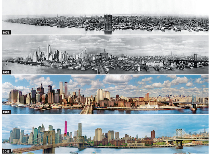
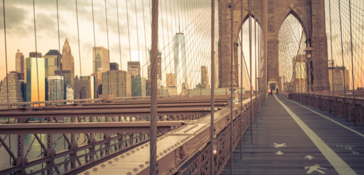
Figure 1: View of Lower Manhattan from Brooklyn, showing how the history and evolution of New York City has been strongly directed by water. Source: https://mymodernmet.com/evolution-new-york-city
Introduction
To start with, what does fluvial geomorphology mean exactly? Well, basically, fluvial geomorphology is about how flowing water shapes the Earth’s surface. So how can this be applied to the urban environment? Because the “geo” mostly refers to “natural” surfaces, and an urban environment is generally far from natural… Indeed, in an urban environment, you might think water is not really shaping or modifying much at all. Just think about the massive concrete banks along most rivers in cities; there is not much change to be detected there. Yet, when you take a closer look, it becomes clear that water does shape and modify cities as much as it does with natural surfaces (Figure 1).
First of all, erosion and transport of sediments by water do occur in urban areas. For example, Kim’s PhD research showed that there are significant amounts of “urban sediments” in the River Aire in Leeds (Figure 2). These urban sediments are basically tiny particles of dirt originating from weathering of tires, erosion of road surfaces, household waste, and sewage treatment works. They are often rich in heavy metals and other pollutants. Erosion, transport and deposition of urban sediments is considerable. Although the effect might be not visible, it can be quite harmful for aquatic life in and around urban water bodies.
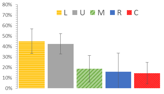
Figure 2: Average sediment source contributions (%) to suspended sediment in the River Aire as measured in Leeds, UK (2014-2017). L: grassland from limestone area (upper catchment). U: urban sediment. M: grassland from millstone grit area (middle catchment). R: eroding riverbanks. C: grassland from coal measures area (lower catchment) (Vercruysse, 2017)
The City’s Relationship with Water
Furthermore, flowing water also visibly shapes how cities look and function (e.g. see previous blog post “The Anthropogenic Catchment”). Rivers have been important drivers for the development of many cities. They provide a means of transport, a freshwater supply, and a waste-flushing system. But with population growth and urbanisation alongside climatic pressures, water in cities increasingly balances between being a necessity and a hazard. As a result, the city’s relationship with water today is not the same as it was a decade ago. Working with nature, rather than fighting against it, is therefore more and more being recognized as a necessary step to make cities more resilient to the adverse impacts of climate change and urbanisation (e.g. see examples in previous Blue-Green Cities blog posts).
In short, the city’s relationship with water is dynamic, which also implies a constant change in how the city looks and function. Similar to fluvial geomorphological processes that shape the Earth’s surface, water-related processes continuously shape cities at micro to city-wide scales. Water shapes the surface (e.g. natural landforms or urban infrastructure), which creates particular conditions (e.g. occurrence of landslides or decreased infiltration in cities). As conditions change, this results in process modifications (e.g. erosion or runoff) and subsequent adaptation of the surface (e.g. new landforms are formed or new infrastructure in built) (Figure 3).
A Cycle of Fluvial Geomorphology
The cycle of fluvial geomorphological processes illustrates that resilience is a dynamic process, involving constant adaptation to changing conditions and processes, and shows again why flood protection using walls is not an appropriate adaptation to flood risk because it does not address the basic conditions causing flooding in the first place (i.e. reduced infiltration), as opposed to blue-green infrastructure.
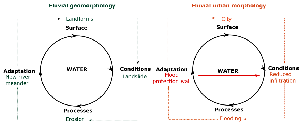
Figure 3: Over time, water shapes the surface, creating specific conditions. This results in a process changes and a subsequent adaptation of the surface, both natural and anthropogenic.
References
Vercruysse, Kim (2017). Processes controlling the sources and transport dynamics of suspended sediment in rivers. PhD thesis, Cranfield University, UK.
Kim is a Research Associate at the University of Leeds, and part of the Urban Flood Resilience research consortium.
All Figures used in this blog are the intellectual property of the author, except where an external source is cited. The featured image is labelled for non-commercial reuse.
No comments yet, fill out a comment to be the first
Leave a Reply