January 31, 2014, by Kathryn Steenson
Happy New Year!
No, we’re not almost a month late; today, Friday, is the start of the Chinese New Year celebrations. Also known as the Spring Festival, it is one of the most important festivals in the Chinese calendar. There are many regional variations in the celebrations, but traditionally the festivities last for several days and begin with a family reunion dinner.
In honour of the Spring Festival, we are highlighting some of our most beautiful and important holdings related to China. These historic maps are not of the whole country, but of a few of the provinces. They were drawn by the Italian Jesuit cartographer Martino Martini (1614-1661). Martini arrived in China as a missionary in 1642. He travelled extensively in the country visiting, according to his own account, seven of the fifteen provinces included in his work.

Map of Hebei province, China formerly known as Pecheli province. The title of the map translates as Pecheli, including Peking, First Imperial Province of China. The cartouche shows two seated Chinese figures, with people standing behind them shading them with parasols. 1655. (Ref MS 416/1)
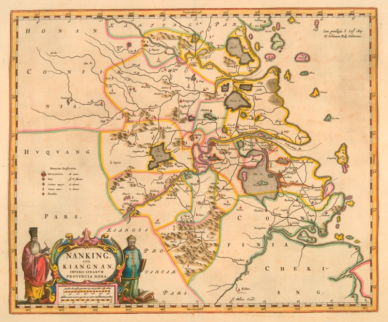
Map of Nanjing province including Kiangnan, China, formerly known as Nanking province. The title of the map translates as Nanking including Kiangnan, Ninth Imperial Province of China. The cartouche shows two figures; a scribe and a man holding a book. 1655. (Ref MS 416/9)
Departing China for Rome in 1651, his ship was captured by Dutch privateers and taken to Norway. Whilst in Europe Martini arranged for the publication of his work. His Chinese maps were published by Johannes Blaeu as the ‘Novus atlas Sinensis a Martino Martinus’ in 1655. This Atlas Sinensis, apart from the technical excellence of its production, is important as being the first European atlas of China. It remained the standard geographical work on that country until the publication in 1737 of D’Anville’s ‘Atlas de la Chine’.
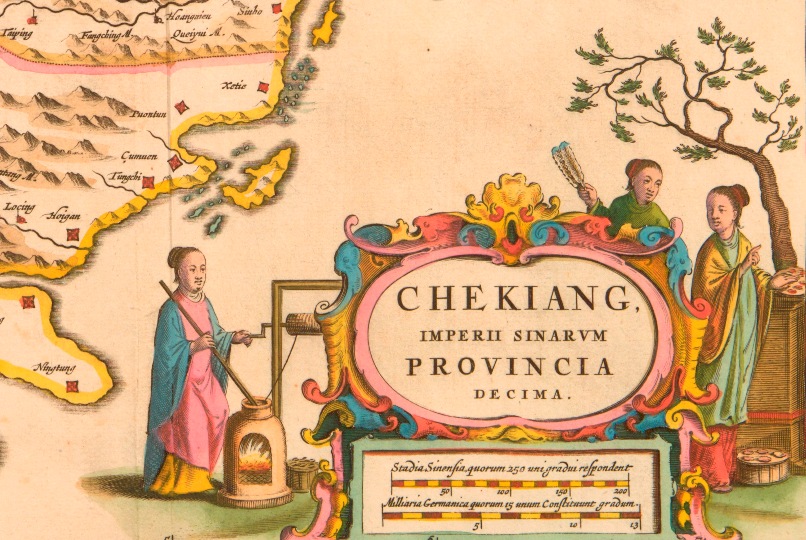
The maps are brightly coloured and show the mountains, rivers, mines and major cities and towns of the provinces. The Great Wall of China is also shown running along the top of Hebei province. Each of the maps has a decorative cartouche (a decorative emblem on a map that contains information such as the title, date, scale etc) showing scenes of Chinese people, occupations and wildlife.
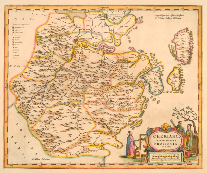
Map of Zhejiang province, China, formerly known as Chekiang province. The title of the map translates as Chekiang, Tenth Imperial Province of China. Dated 1655. (Ref MS 416/10)
Detail from a map of Zhejiang province, China, formerly known as Chekiang province, dated 1655, showing what is possibly the first European illustration of silk or cotton making in China. (Ref MS416/10)
At some point the atlas was dismembered and the plates removed. If you’re interested in China’s heritage, you can view digitised versions of all fifteen maps in our Historic Collections Online gallery, as well as some of our nineteenth century photographs of China, which we have previously blogged about.
The University of Nottingham Ningbo Campus will be closed for two weeks to allow staff and students to celebrate. Closer to home, on Sunday at University Park Campus, Lakeside Arts Centre will welcome in the Year of the Horse with an afternoon of traditional Chinese dancing and music, followed by a spectacular fireworks display. More information is available from Lakeside Arts Centre.
No comments yet, fill out a comment to be the first


Leave a Reply