10/06/2024, by aezcr
Weelie’s Taing… a weelie interesting place-name…
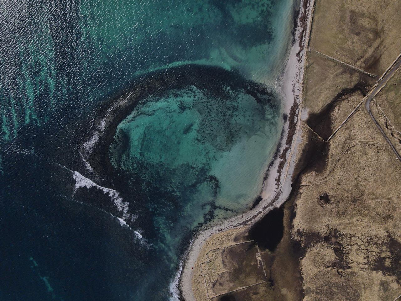
Weelie’s Taing is a tidal feature found at the top of North Wick on the east side of Papay, south of Hundland. Thought by some to be a natural feature, or possibly a fish trap, it has what might be a sheep refuge on the south-eastern end.
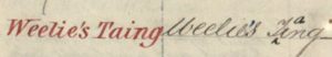
Extract from the Ordnance Survey showing ‘corrections’ to the Weelie’s Taing entry.
The inclusion of the apostrophe in this Ordnance Survey name suggests a personal name, however no such name appears in the Papay censuses, and a look at the name book for the Ordnance Survey is perhaps revealing. While the modification, seemingly done latterly in the process of the survey, of ‘ting’ to ‘taing’ is correct, ‘ting’ being the Papay pronunciation, the addition of the apostrophe may be misleading. As such a personal-name interpretation seems unlikely.
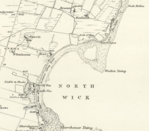
Detail from the 1882 Ordnance Survey map of Papa Westray showing Weelie’s Taing. Reproduced with the permission of the National Library of Scotland.
While the earliest form is from the 1882 OS map (the area was surveyed in 1879), the name is thought to derive from ON hvíla, ‘to rest’ (ONP) and can be found in the Norn word wheeliecruese ‘a place where a funeral cortege rested’ (Marwick, 1929), from hvíla plus crue ‘small enclosure’ (Sandnes, 2010). Marwick, noting in 1929 that the word was already obsolete, gave two other examples, Wheelie Kreus, Sanday, and Wheelda Krues, Stronsay (Marwick, 1927). There is the possibility that the ‘s’ in the Papay name may be from the reflexive form hvíla sik ‘rest, recover’, the Dictionary of Old Norse Prose entry for which references Færeyinga saga and a passage where a ship is laid up and resting. The absence of early forms and other place-name examples, however, make this difficult to prove (Judith Jesch, personal communication).
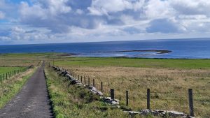
Weelie’s Taing as seen from inland, near Gowrie.
The ‘taing’ element in Weelie’s Taing may be ON tangi ‘an isthmus, a headland’ (ONP) or Scots ‘spit of land’ (DSL), and it is of course also very close to ‘tang’, a dialect ‘collective term for large coarse seaweeds’ (OED), which were an important commodity in island economies.
Archaeological evidence (Pollard, Gibson and Littlewood, 2016) indicates that the site was a busy harbour with both low- and high-water piers active during the Norse period. Following Marwick, Pollard et al propose that the name could derive from the transporting of corpses to their final resting places and so may ‘suggest a harbour of spiritual significance’. If this were the case then presumably the burial would have taken place at one of several holy sites on the island, St. Boniface’s being the most likely candidate. This is an intriguing possibility, although the position of the harbour on the north-eastern end of Papay doesn’t seem to lend itself to the inter-Orkney arrival of the dead.

Aerial view of Weelie’s Taing, Papa Westray. Image courtesy and Copyright of Jonathan Ford (www.jonathanford.org).
The archaeological evidence of both wharfs and piers points to ‘maritime activity on a considerable scale’ and indicate that Weelie’s Taing was ‘a port of some significance’ (Pollard et al). Deep-sea fishing activity seems to have been a primary reason for the port’s existence, although evidence of fish-processing in the immediate area of Weelie’s Taing has not yet been found. Another use for the port could have been as a stopping point for the north/south route to Shetland and beyond to Norway probably via Fair Isle, and, since North Ronaldsay lacks a sheltered harbour it would have been the most northerly harbour in Orkney. While Pierowall (Westray), just to the west, was the dominant harbour and destination in the area, Weelie’s Taing seems to have been a holding port at which to wait for the right sailing conditions, ‘an outport for the major settlement at Pierowall’ (Pollard et al), avoiding the tidal rips around Papay and Westray.
This leads to another possibility for the place-name, or perhaps a subtle re-interpretation, that of ON hvíla sik plus tangi, giving a simple explanation of a safe, sheltered spit of land, a place to stop when the seas to the north are too rough, a place to ‘rest’ oneself before a journey, or at the end of one.
Matthew Blake and Corinna Rayner
Further Reading
Marwick, Hugh, ‘Antiquarian Notes on Stronsay’, Proceedings of the Orkney Antiquarian Society (Kirkwall: Orkney Antiquarian Society, 1927).
Marwick, Hugh, The Orkney Norn (Oxford: Oxford University Press, 1929).
Pollard E., J. Gibson and M. Littlewood, ‘Interpreting medieval inter-tidal feature at Weelie’s Taing on papa Westray, Orkney, NE Scotland’ Journal of Maritime Archaeology, 11 (2016), pp. 299–322.
Sandnes, Berit, From Starafjhall to Starling Hill: An investigation of the formation and development of Old Norse place-names in Orkney (Scottish Place-Name Society, 2010).
Sigurðardóttir, Aldís et al. (eds), Dictionary of Old Norse Prose (ONP) (Copenhagen: University of Copenhagen, 1989‒2021), https://onp.ku.dk/onp/onp.php
See also: Canmore: https://canmore.org.uk/site/3246/papa-westray-weelies-taing and A Dictionary of the Older Scottish Tongue (up to 1700): https://dsl.ac.uk/entry/dost/weill
I think there might be parallels for your ‘hvíla sig’ explanation in Iceland. I did a basic search (https://nafnid.is/leit/ornefni/hv%C3%ADl/sida/1) which shows lots of coastal hvíl(d)- names, though none ending in ‘tangi’. One from Ós in Ísafjörður has an explanation to go with it which mentions the mooring of boats/ships in calm weather (https://nafnid.is/ornefnaskra/16929, p.3). It’s rare for anyone in these registers to explain a name so this is a gem! Of course, this a modern account, and at a stage when Icelanders were ‘commuting’ to booths in the fishing season, but does relate to fishing.
I wonder whether sometimes these names might relate to places where seals rested as well. Seals and boats need the same kinds of beaches?