« return to post

Ma 5420
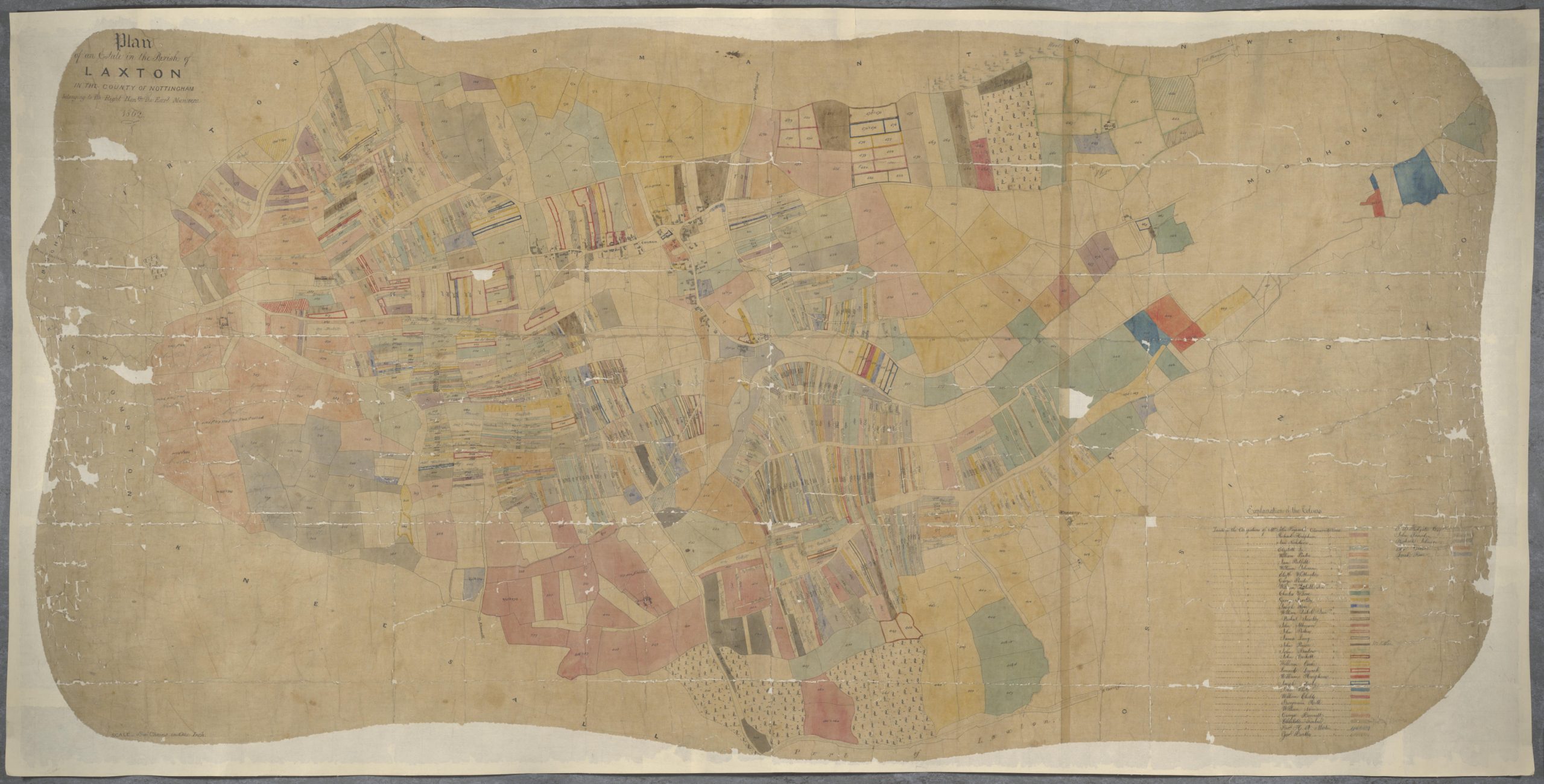
Detailed coloured hand-drawn map of land in Laxton, with pieces belonging to Earl Manvers marked with an individual number in black. The map is colour-coded to indicate the holdings of 38 named tenants. Individual strips of land in the open fields are clearly shown. Ref: Ma 5420


