« return to post


Geographia Pictorial Plan of London [detail]
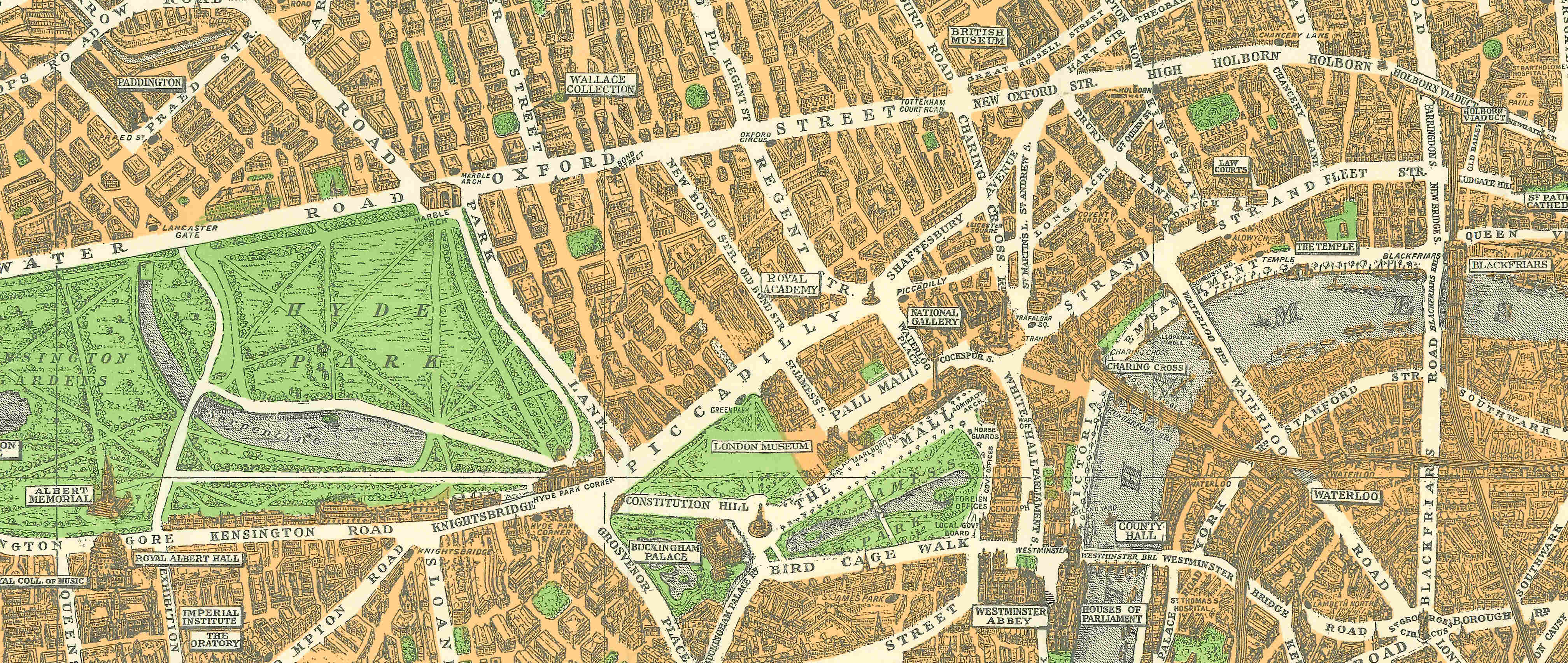
Detail from Pictorial Plan of London. Geographia Ltd., London, 1937 Coronation Edition. Fold-out Map with Card Cover, 46x72cm. RGS-IBG Collections rgsM070601A
Detail from Geographia Pictorial Plan of London, with parks coloured light green and built-up areas coloured coral and drawn in three-dimensional style
