October 8, 2019, by lzzeb
Topographical art, landscape history and current landscape management policies in NW Italy
A blog by Professor Charles Watkins
The coast and mountainous interior of North West Italy were popular with British tourists and travellers in the nineteenth century. The number of visitors rapidly increased after the defeat of Napoleon in 1815 and from 1835 onwards more and more of these people settled along the coast. Many visitors and residents were keen artists. In our Leverhulme Trust funded project ‘British amateur topographical art and landscape in North-western Italy 1835-1915’ we identify and analyse drawings, paintings and photographs by British and other visitors and residents in North West Italy. One outcome of the project is the Portfino Landscape Exhibition which was held in the well-known international resort of Portofino (NW Italy), two venues in Genoa and at Nottingham in the summer and winter of 2018. The exhibition is now available online at https://topographicalart.wordpress.com/exhibitions/portofino-landscape-exhibition/portofino-landscape-exhibition/.
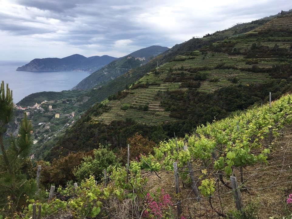
The landscapes of North West Italy have changed dramatically over the last hundred years. The coastal areas are now characterised by the dense development of hotels, houses and industry linked by many new roads and motorways. Some of the inland areas have suffered from intense rural depopulation and land abandonment. This means that many former pastures and cultivated agricultural terraces are now covered with naturally regenerated woodland and traditional forms of agriculture and woodland management have largely disappeared. The relationship between local agricultural, pastoral and silvicultural production and individual rural landscapes is one of the key themes of our research project (Piana et al 2018; 2019).
Funding by a School of Geography Research Capacity and Networking Award enabled us to develop new research links with some of the local Regional and National Parks, including the Cinque Terre National Park and Portofino National Park. We presented a paper at a meeting, held at the Santuario di Nostra Signora di Soviore in the hills above Monterosso, to help develop guidelines for the historical and environmental characterization of rural landscape and local products. A field visit to the slopes above Riomaggiore included discussions with local producers about the difficulties of cultivating vineyards on the steep cliffs bisected by a busy tourist path. At another site, Punta Mesco near Monterosso some olive and vine terraces are in the process of being restored by the Italian heritage charity FAI in connection with Cinque Terre National Park.

Santuario di Soviore, Monterosso
The paper we presented examined the extent to which amateur topographical art is a way of rediscovering former cultural landscapes obscured by recent ‘re-wilding’. The analysis of the images and comparison with present day landscapes and intervening historical maps demonstrate the extent and rapidity of change, provide insights into forgotten and hidden geographies and help to generate ideas about how lost landscapes might be recreated. We showed that the reconnection of topographical art with the landscapes that it depicts can be a way of demonstrating the extent and scope of landscape change. Also, if contextualized, topographical art can provide useful insights into current landscape management issues.
Piana, P., Watkins, C., & Balzaretti, R. (2018). Travel, modernity and rural landscapes in nineteenth-century Liguria. Rural History, 29(2), 167-193 https://doi.org/10.1017/S0956793318000079
Piana, P., Watkins, C., & Balzaretti, R. (2019). The palm landscapes of the Italian Riviera. Landscapes, https://doi.org/10.1080/14662035.2019.1575112
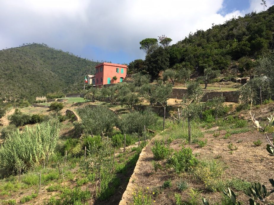
Restoration of abandoned terraces at Punta Mesco, Monterosso
No comments yet, fill out a comment to be the first


Leave a Reply