February 28, 2019, by lzzeb
Map of the month. Map of the County of Nottinghamshire, George Sanderson, 1836
A blog by Professor Charles Watkins
The surveyor George Sanderson, of Mansfield, was born in Richmond, Yorkshire in 1798 and took over the Mansfield firm in 1828. Like most early nineteenth century cartographers he was kept busy charting the many ways that Britain was being reconfigured and transformed. He surveyed and mapped enclosure awards, produced several tithe maps and published a Parish and Poor Law Union Map of the County of Nottingham, following the Poor Law Amendment Act of 1834.
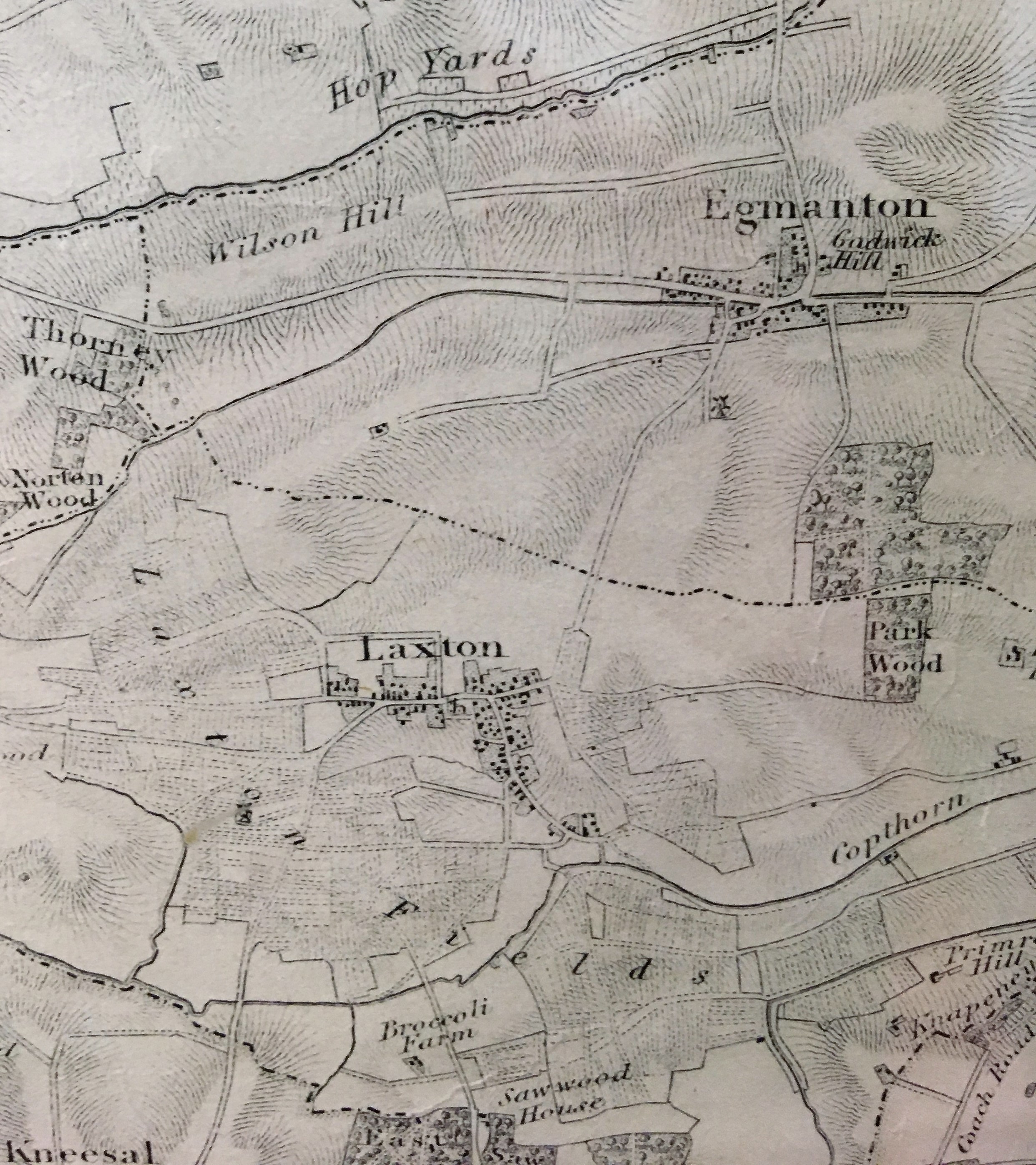
His Map of the County of Nottingham from ‘a Careful Survey Made in the Years 1834 & 1835’ was published on 15 September 1836 by J & C Walker of 3 Burleigh Street, Strand, London. The extract shown here above from Sanderson’s map depicts parts of the parishes of Laxton and Egmanton about 24 miles to the northeast of Nottingham. Sanderson ‘Respectfully Inscribed’ the map to the ‘Nobility, Clergy, & Gentry of the County.’ There is also an ornamental border and to the lower right a vignette view of Welbeck Abbey from the southeast by John Sanderson showing herds of deer grazing near the lake of the 4th Duke of Portland’s park (see image of vignette below). The map is at the scale of 1 inch to 1 statute mile and measures 110 cm by 140 cm, too large to be reproduced with any clear detail here. Sanderson’s map is held in the School of Geography map collection, but until Sunday 7 April 2019 is on display at the exhibition SYLVA: ‘To slowly trace the forest’s shady scene’ at the DH Lawrence Pavilion, Lakeside Arts, University of Nottingham.
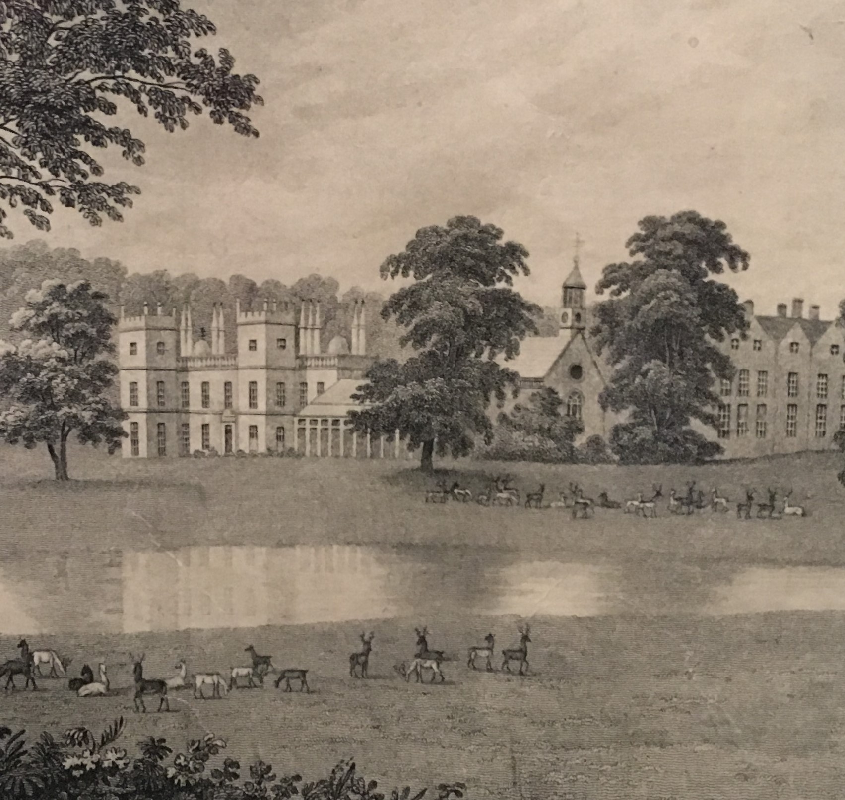
View of Welbeck Abbey from the southeast by John Sanderson
The Laxton and Egmanton detail from Sanderson’s map illustrates the way in which cartographic sources can illuminate landscape history. The individual village properties are mapped including both parish churches. There are very few outlying properties other than ‘Broccoli Farm’ (currently Brockilow Farm) and one windmill for each village. Several parishes in Nottinghamshire remained unenclosed in the 1830s and Laxton was one of these. The borders of the open ‘Laxton Fields’ are carefully marked and indications of the distribution and orientation of individual strips of land and the access routes known as sykes are mapped. Laxton remains famous today for retaining its medieval strip farming system. There are no open fields shown in Egmanton whose Enclosure Act had been passed in 1821. Other features depicted on Sanderson’s map include some small enclosed ‘Hop Yards’ and several broadleaved woods. The diversity of woods depicted on the full map is remarkable: small, precisely named fox coverts, especially in the south and east of the county; clumps and avenues of trees in parks, as at Clumber, Wollaton and Newstead Abbey; remnants of Sherwood Forest near Edwinstowe and ancient woods scattered over the clay lands to the east of the county as at Egmanton and Laxton. The map shows a county in the throes of change. The town of Nottingham in 1836 was still tightly hemmed in by open fields and meadows which were to remain unenclosed, with dismal consequences for the health of the burgeoning population, until the Nottingham Enclosure Act of 1845.
The Laxton estate is currently on the market: https://www.rightmove.co.uk/property-for-sale/property-57386619.html. The estate agents describe it as: ‘A unique 1,845 acre heritage estate, including 525 acres of unenclosed open fields, producing in excess of £230,000 per annum and of significant educational and curatorial interest.’ The British Agricultural History Society’s 2019 conference at the University of Nottingham includes a field visit to Laxton on 9 April: http://www.bahs.org.uk/Spring_Conference_Programme.html
No comments yet, fill out a comment to be the first


Leave a Reply