May 15, 2018, by lzzeb
New Orleans: The city and the swamp
In April Dr David Beckingham travelled to the American Association of Geographers (AAG) Conference in New Orleans. The conference last visited NOLA in 2004, just over a year before Hurricane Katrina battered the Mississippi delta. Here he reflects on thinking historically about the city.
Colonial foundations
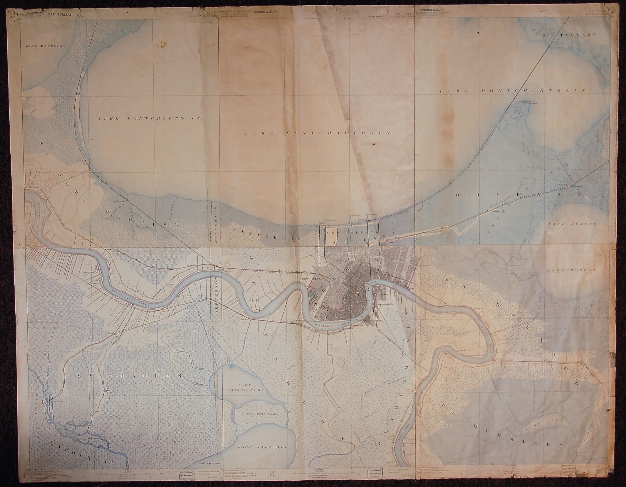
Pinched between Lake Pontchartrain and the mighty Mississippi river, New Orleans is a city built on sediment shifted and shaped by water. Like generations of Native Americans before them, early French settlers were keen to exploit the area’s watery geography to port their goods between riverbank and lakeshore. They planted a city in 1718 on elevated Mississippi sediment, protected by what mid-eighteenth century plan described as a ‘Bank to preserve the Town from the Inundation’ [1].
Louisiana, US Department of the Interior, detail from 1890-1910 Louisiana survey, panels published 1921-34 (School of Geography map archive)
As the gateway to the Mississippi, the city’s strategic location made it an important asset in a series of international power plays as French, Spanish and British imperial conflicts crossed the Atlantic. After independence from Britain the nascent United States was keen to assert its right to the Mississippi. In the ‘Louisiana Purchase’ of 1803 Thomas Jefferson’s administration acquired France’s land claims west of the Mississippi, effectively doubling the size of the country overnight. As part of the handover the American flag was symbolically raised in Plaza de Armas (now Jackson Square), the civic centre of New Orleans.
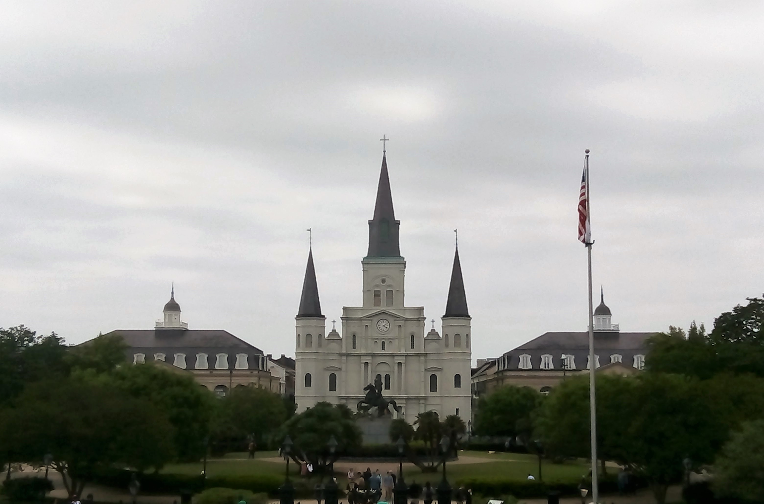
Jackson Square
Owning Louisiana was one thing: governing it, quite another – not least because its Spanish and French Catholic cultural and legal systems differed from those of former British colonies [2]. But there was something else that needed governing, for the prize of trade and commerce was always worth the inevitable price of having to manage the very thing that made New Orleans viable and vital in the first place. The city’s governors were forced to join the long war with water [3].
Slavery and civil war
Louisiana was formally added to the Union in 1812, in the year that the United States declared war on a Britain desperate to block American trade with its Napoleonic-enemy France. Future President Andrew Jackson secured New Orleans, repelling British attempts to take the city [2]. The advent of the steamship saw trade and prosperity increase in the 1820s and 1830s. It created not only new geographies of interaction but for some also, as Ari Kelman argues, a new sense of progress – a world of goods and people brought, and in the case of slaves forced, together by trade [4].

The Mississippi
In the 1860s the trade in people helped bring America to war, this time with itself, as continental expansion exposed a constitutional crisis over slavery and states’ rights. By February 1861 Louisiana and six of her southern neighbours had seceded from the Union. Three months later the first shots were fired in the bloodiest conflict in US history. Union ships were sent to blockade the Mississippi, prevent cotton exports and choke southern Confederate ambitions. In April 1862 Union forces successfully breached New Orleans’s defences and occupied the city [2].
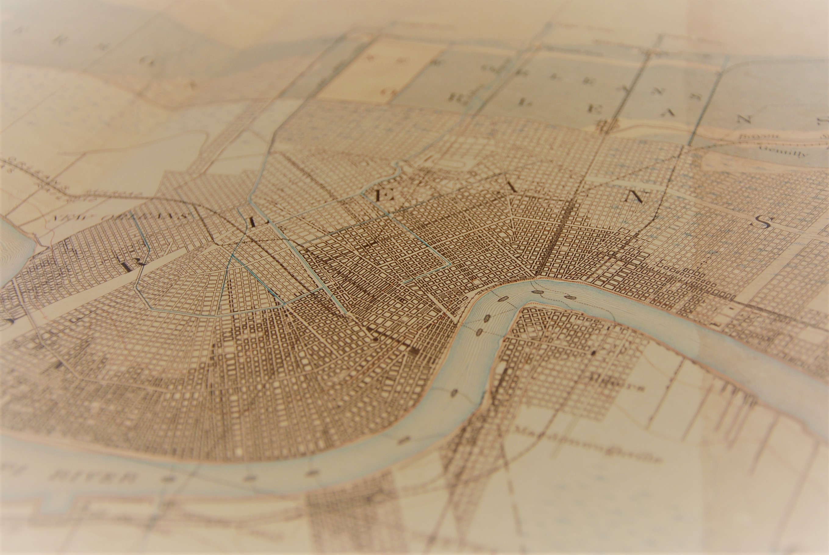
Businesses denied access to the Mississippi during the war continued to trade along an expanding national railroad network after it. New Orleans was forced to react, running rails right along its river front to service the city’s wharfs and docks (see Picture 1) [4]. The war had also taken its toll on the city’s flood defences. A succession of inundations in the 1860s and 1870s prompted a serious review. In 1879, presented with evidence that better levees would aid navigation, Congress took the decision that flood control should become a federal concern. Flooding in New Orleans was definitively America’s problem [3].
Water, water…
Hurricane Katrina’s 100mph winds whipped up a storm stage that breached the federal levees that guarded New Orleans. Structures built up over centuries to keep out water now kept it in, with devastating effect [5].
Flooding affected around 80 per cent of the city, but its effects were particularly acute in the lowest lying, lower income, neighbourhoods, such as the predominantly African-American Lower Ninth Ward. Here communities faced what Louisiana State University geographer Craig Colten describes as a ‘double jeopardy’, living in the most vulnerable areas without sufficient means or support to evacuate [4].
The distance of time does little to diminish the sheer scale and loss suffered by Katrina. For geographers it quickly became a case study of the entanglement of environmental processes, political management and social effects of hazards. It is a powerful reminder of the capacity of Geography’s ‘holistic’ or ‘integrated’ view, as students are often told.
In a city like New Orleans that view has to include historical insight, the locational justification for the city having, from its very foundations, been a near-daily source of danger. It is also an acute challenge in the face of climate change. This isn’t a story told backwards, then, a simple question of what happened in the past. Rather – as Craig Colten made clear in his plenary talk at the conference – historical geography provides space to think forwards. To explain how New Orleans continues to be made by a centuries-old commercial decision to plant a city in a swamp is also to expose how the decisions of today will shape the city of tomorrow.
Reading
[1] D Meinig (1986) The Shaping of America: A Geographical Perspective on 500 Years of History: Volume 1, Atlantic America, 1492-1800 (Yale University Press)
[2] D Meinig (1993) The Shaping of America: A Geographical Perspective on 500 Years of History: Volume 2, Continental America, 1800-1867 (Yale University Press)
[3] C Colten (2006) An Unnatural Metropolis: Wresting New Orleans from Nature (Louisiana State University Press)
[4] A Kelman (2006) A River and Its City: The Nature of Landscape in New Orleans, (University of California Press)
[5] BBC News online Special Reports, http://news.bbc.co.uk/1/hi/in_depth/americas/2005/hurricane_katrina/default.stm, last accessed 11 May 2018
No comments yet, fill out a comment to be the first


Leave a Reply