December 4, 2018, by Lexi Earl
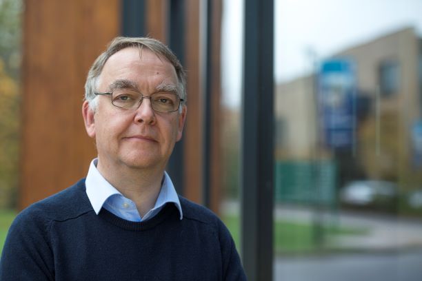
Meet the Beacon: Prof Murray Lark
Murray Lark is Professor of Environmetrics and a member of the Future Food Beacon. Prof Lark is interested in spatial statistical models and their application to problems in sampling and experimental design and the analysis of data from large surveys. Much of his work is concerned with understanding constraints on crop performance with respect to soil water and nutrients. He is leading a UKRI GCRF project working in Zimbabwe, Zambia and Malawi on conservation agriculture. This project is focused on building research capacity and partnerships in these countries, so that an integrated assessment can be made of options for “climate smart” agriculture and the impact of different strategies on food and water security. Prof Lark is interested in the way messages about uncertainty are framed, and how research findings are communicated to different stakeholders. Prior to joining UoN, Prof Lark was at the British Geological Survey.
In this interview, Murray talks to Lexi Earl about his research, current projects, and reasons for joining the Future Food Beacon team.
Can you tell me a little bit about your research and career?
I joined the University of Nottingham in December 2017. Prior to that I was at the British Geological Survey. Before BGS I was at Rothamsted Research where I led the Environmetrics research group in the Biomathematics Department. My particular area of interest is in spatial statistical methods for soil science, sometimes called pedometrics. I enjoy developing mathematical models of spatial variation which capture features of how real soil varies. I am interested in the variation of the soil itself, the processes in the landscape which give rise to it, but a quantitative understanding of this variation at different spatial scales is also essential for practical purposes if we are to obtain robust information about soil and crop systems. I am therefore interested in how statistical models can be used to design efficient experiments or sample plans, and then provide useful information. This information might take the form of a map, or an equation to predict a property of the soil.
My focus now is on understanding constraints on crop performance with respect to soil water and soil nutrients. I am working with colleagues from the UK and Africa in several connected projects concerned with nutrient status of crops and how these are controlled by soil factors at the landscape scale. I am also working on conservation agriculture which is a set of strategies aimed at making agriculture more resilient in a changing climate. Within the UK I am working on methods to extract information from large data sets collected on-farm, and am examining how sensors can be deployed to provide farmers with real-time information.
How did you become interested in your area?
I was always interested in the physical environment. In the part of Africa where I grew up the landscape is ancient. Some of the erosional landsurfaces began to form when Africa was still part of the Gondwana supercontinent. Crossing the Zambezi valley is like time-travel, and as you encounter erosion surfaces of different age, at contrasting elevation, so the climate, soil and vegetation change. I was intrigued by the soil, and how soil under contrasting tree cover differed in its properties. However, my main interest when I was a youngster was in elephants. One of the problems with managing elephants is the destructive effect they have on trees. When I was about 10 years old I decided that it was necessary to measure the rate at which the tree canopy was being lost to elephant browsing in parts of Zimbabwe. No one could tell me what the rate was, so I decided to find out myself. The rate of tree loss is not obviously an easy thing to measure. I decided to approach the problem using aerial photographs. I obtained repeat photographs of the same area, with a large elephant density. My plan was to count the trees on each and so estimate the rate of loss. But of course, as soon as I looked at the photographs, I realised that counting all the trees was an impossible task. So I had to think about sampling, how you can make estimates of quantities that you can’t measure exhaustively by appropriate sampling design. That is when I began to get interested in a mathematical framework to address the problems of obtaining environmental information, which is what environmetrics is all about.
I developed an interest in mathematical biology, and so I applied to Oxford, intending to study Zoology. Early in the first year I went to some introductory lectures on the physical environment for biological scientists, given by a soil scientist at the university. He talked about the soils and landscapes of the Zambezi valley. It did not take long for me to set zoology aside, and I took a degree in Pure and Applied Biology which allowed me to spend a lot of time studying soil science, and also statistics. In my D.Phil research I looked at the spatial variation of remote sensor data, and multivariate methods to analyse them. I then held a University of Wales fellowship where I applied some of these ideas in arid environments of southern Spain.
When the fellowship ended an opportunity arose at the BBSRC’s Silsoe Research Institute where they were interested in precision agriculture. The idea of precision agriculture is to understand the spatial variation of soil–crop systems at within field scale, and to adjust inputs in response to this variation, rather than treating soils as uniform. After the move to Rothamsted, I continued looking at national scale soil monitoring options, from a statistical design point of view. Then I moved to BGS where there was still a lot of interest in soil science in relation to agriculture but then a range of other topics as well. I became involved with some of the work that was being done in Southern Africa on micronutrients in soil and crop. That was the first area where I was collaborating with people at the university here, as well as colleagues at BGS.

Tell me about your current project in Southern Africa?
I lead a project called CEPHaS (UKRI GCRF funding) on conservation agriculture in Zambia, Zimbabwe and Malawi. CEPHaS looks at strategies for crop management in an increasingly erratic climate. Conservation agriculture (CA) is a set of what are called “climate smart” strategies to make agriculture more robust. It entails the avoidance of cultivations to maintain soil structure, the use of mulches to protect the soil and enhance its organic status, and crop rotation to manage pests and diseases.
It has been recognised that we know very little about what changes happen in the soil under CA, particularly as so far it affects the dynamics of water in the soil. One area which has not been considered at all is the implications of these practices for the recharge of ground water. Ground water is sometimes undervalued as a resource in Africa. But boreholes or shallow wells are very important for many communities. No one really knows what the effects of uptake of conservation agriculture would be on groundwater. Does the physical improvement in the soil mean you will get greater infiltration and therfore improved recharge? Or does improved retention of water in the top-soil, which may then be lost by the crop’s evapotranspiration, mean that you will see reduced recharge? Our objective is to build the capacity of a collaborative network in subsaharan Africa, along with UK partners, which is able to evaluate how CA practices affect the behaviour of water in the soil and so the resilience of cropping systems and their impact on groundwater supplies. Core to this are the interdisciplinary links we are creating between soil physicists on one hand and hydrogeologists on the other, and geophysicists. And statistics provides the glue to hold it all together, of course!
Is your research easily applicable in ordinary settings?
That is a very important question. The current agenda for the Global Challenges Research Fund in the UK should be making us think much harder about it than we have before. It is very easy to say “we are looking at how certain agricultural practices affect the soil, and its behaviour, so it should be very obvious that there are potential benefits for agriculture and the agricultural sector” but of course that doesn’t just happen. It is partly the responsibility of scientists to engage with partners to make sure that that impact is realised.
Because of this we are engaging with a range of stakeholders in the CEPHaS project. During the project network meeting in July this year in Malawi we met representatives from the land resources and water resources departments of the Ministry of Agriculture, Irrigation and Water Development. We also met representatives of international donors, local NGOs and government researchers. This enabled the project team as a whole to develop our scientific ideas in the context of what policy makers, extension workers and NGOs are seeing on the ground.
One particular theme that bears both on science and its impact, and one in which I have taken a direct interest, is the effective communication of scientific findings which have an element of uncertainty. My work is about statistical inference from data. This is concerned with the variability which arises from the complexity of processes in the natural world, and the uncertainty which is therefore attached to any experimental finding or estimate from a survey. It is not easy to communicate this to a general audience, particularly when the most natural way to express uncertainty is in terms of probabilities. I have often run into this difficulty when planning or explaining research to wider stakeholder groups such as farmers or policy makers. Key to the more general question about how we ensure impact of our research is how we frame the ways to communicate it. You can’t just leave that to chance. You need to be aware of how people handle numerical information, the heuristics they use to try and interpret it and make decisions with it. I have been fortunate to have the opportunity to collaborate with psychologists on these questions. They are by no means settled, and there are many interesting problems to be tackled which are essential to effective communication of science.

How does being here at UoN within Future Food help you achieve your goals?
There are many opportunities, and these arise from the scope for interdisciplinary collaboration. Before starting at the University I had collaborations in soil geochemistry, soil-root interactions and the effects of zero-tillage on greenhouse gas emissions from the soil. Within the Future Food Beacon I hope to be able to widen that collaboration to look at food and agricultural systems more broadly. Agricultural systems are set in the spatially variable landscape, and that means that their management and optimization requires quantitative insight into the scale-dependent variation of the environment. That is how we might reduce costs and environmental impact of farming by spatially variable application of inputs, for example. In the past the study of agricultural systems in the field and the study of plants or animals at the molecular scale have been seen as mutually exclusive activities, competing for limited resources. But neither approach can deliver on its own, and I would suggest that quantitative methods to examine processes at multiple spatial scales are key to the necessary integration. I would also like to develop links with the social sciences. Most smallholder farmers manage small patches of land in complex ways, often based on sophisticated ecological understanding. It would be very interesting to understand better how such farmers perceive their environment and integrate information from different scales, and I would wager that spatial statistics could help with that.
Do you have a greatest career moment?
A career in applied science offers varied kinds of job satisfaction. For example, I work with statistical models which we develop to capture aspects of how the world works in ways which are practically tractable. It is always gratifying when you see that a mathematical abstraction for describing something as complicated as the variability of the soil, has actually worked because the numbers drop out as you predicted. We can use numbers to make sense of the complexity of the world, that is always deeply satisfying to see. On the other hand, just the other week in Malawi I saw a geophysical array being set up on a long-term conservation agriculture experiment as part of the CEPHaS project. This experiment has been running for the last twelve years or so, and it has produced all sorts of interesting information about the system, but this bit of extra kit that we’re getting in the ground is going to open up a whole new perspective on aspects of water and soil under conservation agriculture that we’ve had no clue about before. That is hugely exciting.
Do you have any advice for others?
I’ve never really tried to organise my career. I’m not a great one for five year plans, I’m a bit sceptical about those. So that is my first bit of advice, not to get too worked up trying to do horizon scanning. My approach is different. I’ve always had an internal agenda of questions that I want to answer about the mathematics of the soil system, and then I try to stay alert for reasons why someone should pay me to tackle them because some important problem hangs on them.
For example, one ‘left-over’ question on my internal list after my doctoral research was about how to estimate certain parameters of a statistical model for soil when the data are particularly messy. I needed a way to decide which estimator was best when two or more disagreed. That sounds dry as dust to the non-statistician but I did not have to wait to long for an opportunity to pursue it with funding from the then Ministry of Agriculture, Fisheries and Food. They wanted to know how to make sensible decisions about monitoring contaminated soil. I was able to hang my scientific interests on their practical agenda. I think that is half the fun of being an applied scientist, being able to spot the opportunities to do something which you think is interesting from the scientific point of view, but which will also have impact. One question near the top of my personal list at the moment is whether there are any laws we can spot empirically or infer from theory about how the variation of soil is structured over scales from pore to continent. Does variation grow smoothly as we consider increasing scales, or are there scales where it goes up in jumps? Again, I would wager that there are some “real-world” problems out there on which one could hang that question!
No comments yet, fill out a comment to be the first


Leave a Reply