
February 6, 2015, by Matt
What on earth do you actually do?!
As a surveyor in the Oil and Gas industry there is a question I get asked a lot: what on earth do you actually do?! Unfortunately, there is no simple answer, but the question is a good one, in that everything I do in my job, is on the earth! Geography, and in particular geomatics, are crucial disciplines in hydrocarbon exploration and production, and it’s estimated that 80% of all upstream data used in BP has a geospatial reference or positional component.
I joined the BP graduate scheme in 2013 as an Applied Geophysicist specialising in Survey and Positioning, having read BSc Geography and an MSc in Environmental Management and Earth Observation. Since joining I have had the chance to travel around the world working on numerous offshore and onshore jobs, and I’ve had the opportunity to develop a host of technical and business skills specific to the energy industry.
In short, my current role within BP involves providing survey, positioning and geomatics support to the Upstream business, including seismic and drilling operations, as well as major engineering projects. Within the Sunbury office I am part of a group of experts that also offer internal consultancy in geodesy and co-ordinate reference systems across the business. Additionally, I’m also responsible for the production and Quality Control of maps and drawings, as well as GIS for the management and analysis of geospatial data.
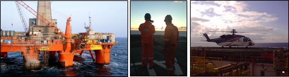
Outside of the office I recently joined the crew of a rig to the West of the Shetland Isles to assist in the drilling of an exploration. The rig was a semi-submersible driller, which means it can be moved to new locations, rather than being fixed to the seabed. As a surveyor I utilised GPS and other positioning technology to move and fix the rig at its new well site.
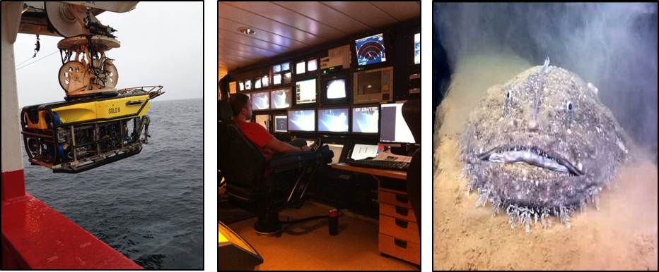
Earlier in the quarter I spent a few weeks on a survey vessel assisting in the construction of a new gas export pipeline. The job involved positioning structures on the seabed to ensure the new pipeline was laid in the right place and sat stable. The main tool used in the work was a Remotely Operated Vehicle (ROV), which is essentially a robotic diver with HD cameras and giant mechanical arms. The ROV is controlled by what looks like an old N64 controller and the “pilot” sits in front of 20 screens as he flies over the seabed and manipulates the various arms and levers. From the ROV, live HD video is streamed to enable all the subsea operations to be completed with ease, and at times the cameras capture some very weird sea life! The weather for this trip saw 80mph winds, so not only did I learn about subsea engineering, but also how to sleep in 12m waves and keep down my lunch when bobbing around in swell the size of a house!
Aside from these trips it’s been a very busy year in other regions and I’ve also been involved in projects ranging from developing a remote control survey boat for Iraq, to searching for naturally occurring gas seepage in Azerbaijan and processing satellite imagery of Oman.


Josh – you were a real pleasure to teach remote sensing to. So pleased to read of your continued success. All best, Doreen.